Build an ATS-Friendly
Satellite Science Specialist Resume
That Gets Interviews
Diving deep into the intricacies of satellite data, a Satellite Science Specialist examines large datasets to extract actionable insights concerning the Earth’s atmosphere, terrain, and conditions. Collaborating closely with aerospace engineers and environmental scientists, these specialists utilize advanced remote…
Satellite Science Specialist Resume Templates
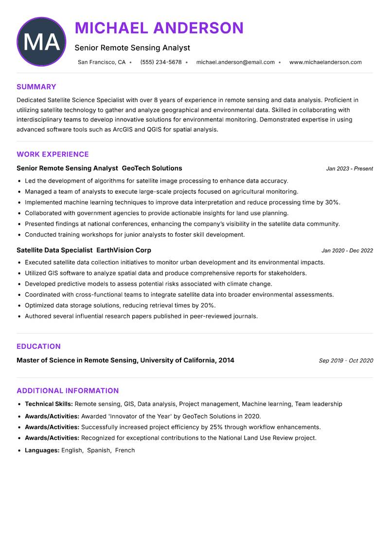
Modern Professional
Use Template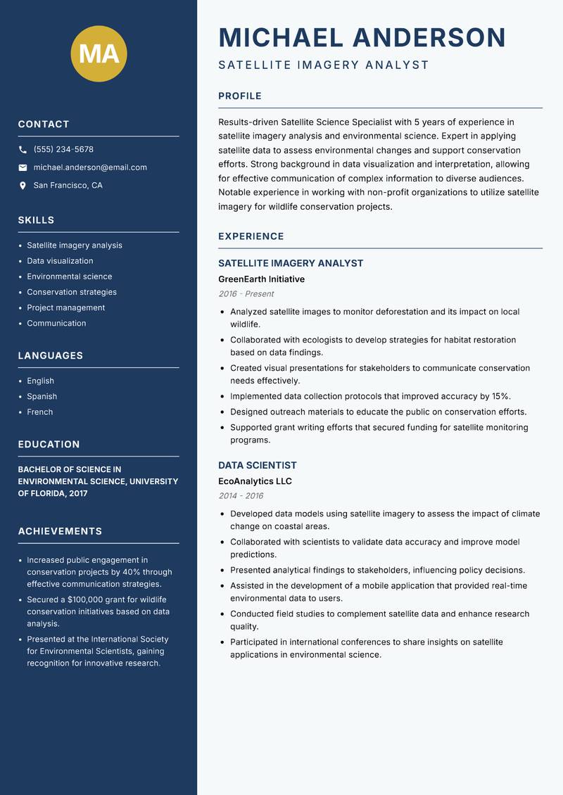
Classic Clean
Use Template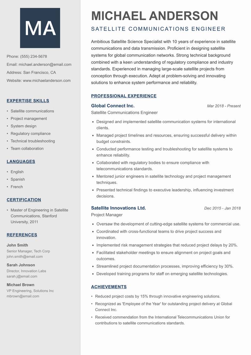
Creative Minimal
Use Template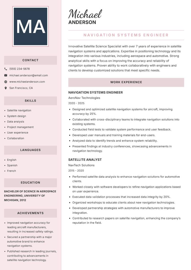
Executive
Use Template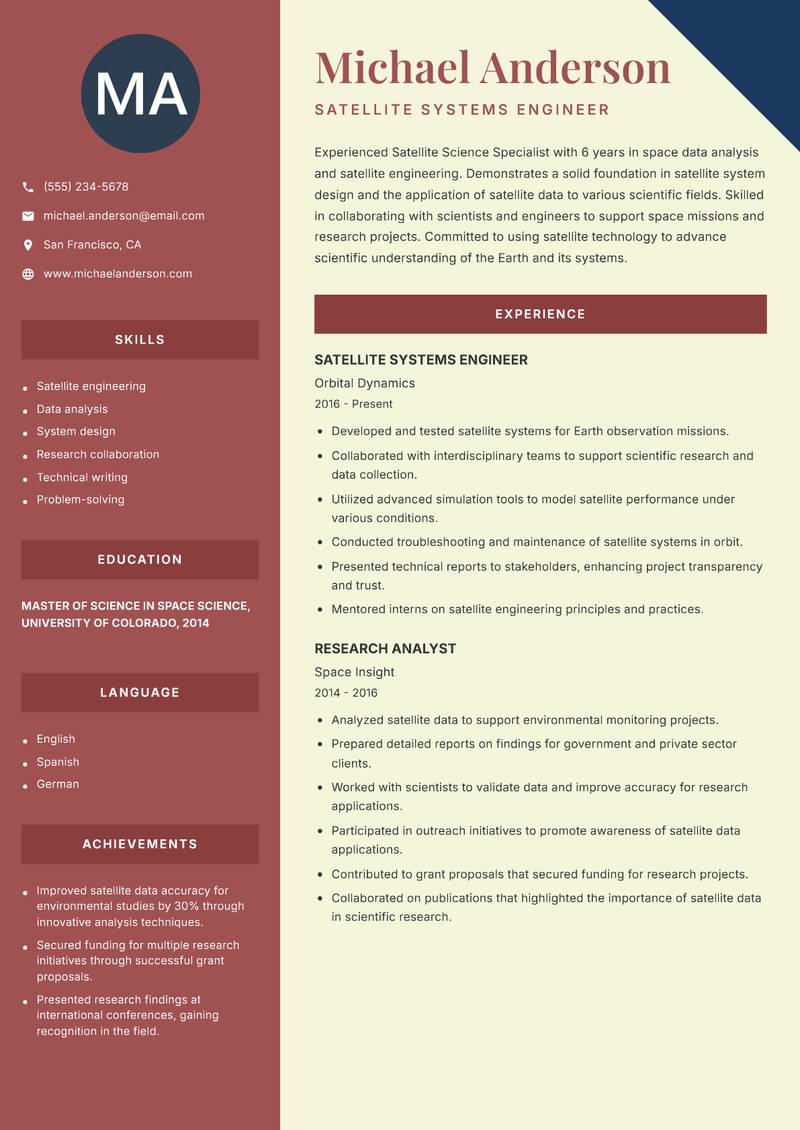
Two Column
Use Template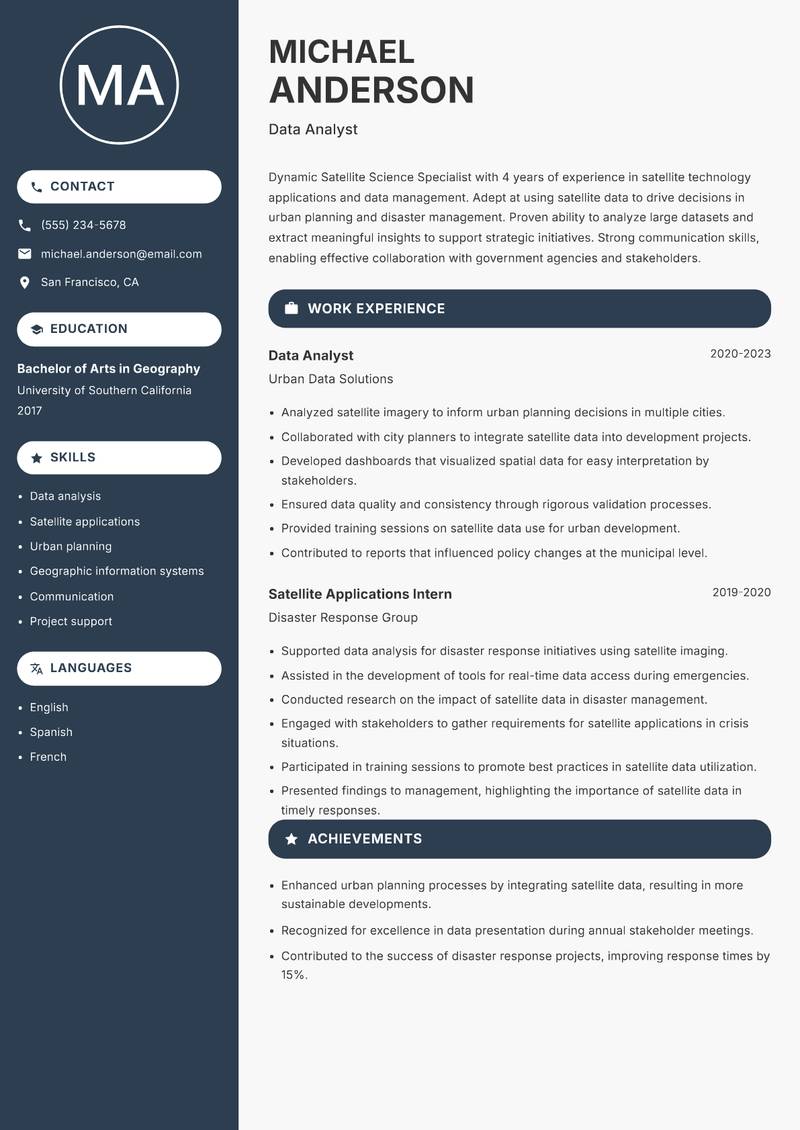
Compact
Use Template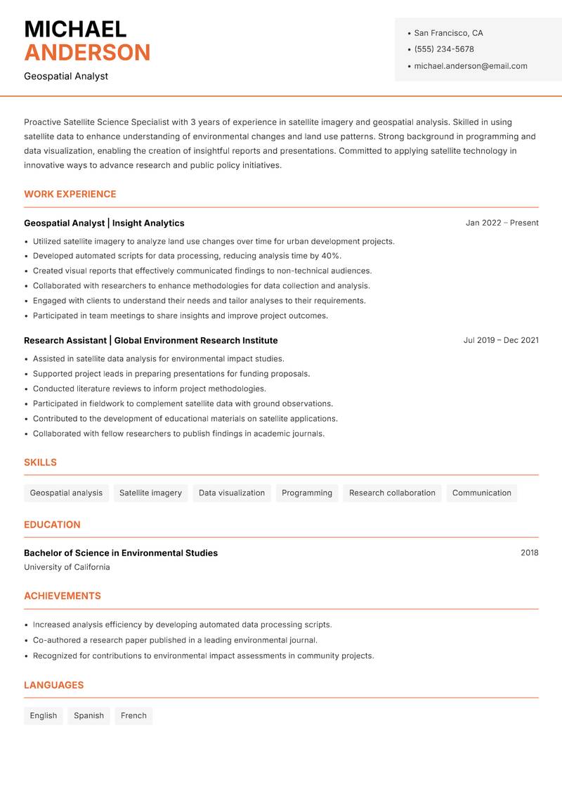
Modern Professional
Use Template7 Real Satellite Science Specialist Resume Examples
Senior Remote Sensing Analyst with 8+ Years Experience
Summary: Dedicated Satellite Science Specialist with over 8 years of experience in remote sensing and data analysis. Proficient in utilizing satellite technology to gather and analyze geographical and environmental data. Skilled in collaborating with interdisciplinary teams to develop innovative solutions for environmental monitoring. Demonstrated expertise in using advanced software tools such as ArcGIS and QGIS for spatial analysis. Proven track record of enhancing decision-making processes through data-driven insights. Passionate about leveraging satellite data to address climate change and support sustainable practices. Committed to continuous professional development and staying updated with the latest advancements in satellite technology.
Description:
- Led the development of algorithms for satellite image processing to enhance data accuracy.
- Managed a team of analysts to execute large-scale projects focused on agricultural monitoring.
- Implemented machine learning techniques to improve data interpretation and reduce processing time by 30%.
- Collaborated with government agencies to provide actionable insights for land use planning.
- Presented findings at national conferences, enhancing the company’s visibility in the satellite data community.
- Conducted training workshops for junior analysts to foster skill development.
🏆 Key Achievements
Satellite Imagery Analyst with 5+ Years Experience
Summary: Experienced Satellite Science Specialist with 5 years of experience in satellite imagery analysis and environmental science. Expert in applying satellite data to assess environmental changes and support conservation efforts. Strong background in data visualization and interpretation, allowing for effective communication of complex information to diverse audiences. Notable experience in working with non-profit organizations to utilize satellite imagery for wildlife conservation projects. Proven ability to manage multiple projects simultaneously while meeting tight deadlines. Passionate about using technology to advance environmental sustainability and address global challenges.
Description:
- Analyzed satellite images to monitor deforestation and its impact on local wildlife.
- Collaborated with ecologists to develop strategies for habitat restoration based on data findings.
- Created visual presentations for stakeholders to communicate conservation needs effectively.
- Implemented data collection protocols that improved accuracy by 15%.
- Designed outreach materials to educate the public on conservation efforts.
- Supported grant writing efforts that secured funding for satellite monitoring programs.
🏆 Key Achievements
Satellite Communications Engineer with 10+ Years Experience
Summary: Driven Satellite Science Specialist with 10 years of experience in satellite communications and data transmission. Proficient in designing satellite systems for global communication networks. Strong technical background combined with a keen understanding of regulatory compliance and industry standards. Experienced in managing large-scale satellite projects from conception through execution. Adept at problem-solving and innovating solutions to enhance system performance and reliability. Highly skilled in collaborating with engineers and project managers to deliver projects on time and within budget. Passionate about advancing technology to improve connectivity in remote areas.
Description:
- Designed and implemented satellite communication systems for international clients.
- Managed project timelines and resources, ensuring successful delivery within budget constraints.
- Conducted performance testing and troubleshooting for satellite systems to enhance reliability.
- Collaborated with regulatory bodies to ensure compliance with telecommunications standards.
- Mentored junior engineers in satellite technology and project management techniques.
- Presented technical findings to executive leadership, influencing investment decisions.
🏆 Key Achievements
Navigation Systems Engineer with 7+ Years Experience
Summary: Innovative Satellite Science Specialist with over 7 years of experience in satellite navigation systems and applications. Expertise in positioning technology and its integration into various industries, including aerospace and automotive. Strong analytical skills with a focus on improving the accuracy and reliability of navigation systems. Proven ability to work collaboratively with engineers and clients to develop customized solutions that meet specific needs. Passionate about enhancing user experiences through advanced satellite technologies. Committed to ongoing learning and applying the latest research in satellite navigation.
Description:
- Designed and optimized satellite navigation systems for aircraft, improving accuracy by 25%.
- Collaborated with cross-disciplinary teams to integrate navigation solutions into existing systems.
- Conducted field tests to validate system performance and user feedback.
- Developed user manuals and training materials for end-users.
- Analyzed data to identify trends and enhance system reliability.
- Presented findings at industry conferences, showcasing advancements in navigation technology.
🏆 Key Achievements
Satellite Systems Engineer with 6+ Years Experience
Summary: Experienced Satellite Science Specialist with 6 years in space data analysis and satellite engineering. Demonstrates a solid foundation in satellite system design and the application of satellite data to various scientific fields. Skilled in collaborating with scientists and engineers to support space missions and research projects. Committed to using satellite technology to advance scientific understanding of the Earth and its systems. Recognized for innovative approaches to data analysis and problem-solving. Eager to contribute to projects that push the boundaries of satellite science and technology.
Description:
- Developed and tested satellite systems for Earth observation missions.
- Collaborated with interdisciplinary teams to support scientific research and data collection.
- Utilized advanced simulation tools to model satellite performance under various conditions.
- Conducted troubleshooting and maintenance of satellite systems in orbit.
- Presented technical reports to stakeholders, enhancing project transparency and trust.
- Mentored interns on satellite engineering principles and practices.
🏆 Key Achievements
Data Analyst with 4+ Years Experience
Summary: Dynamic Satellite Science Specialist with 4 years of experience in satellite technology applications and data management. Adept at using satellite data to drive decisions in urban planning and disaster management. Proven ability to analyze large datasets and extract meaningful insights to support strategic initiatives. Strong communication skills, enabling effective collaboration with government agencies and stakeholders. Committed to promoting the use of satellite data for societal benefit and environmental stewardship. Eager to leverage skills in a role that contributes to innovative solutions in satellite applications.
Description:
- Analyzed satellite imagery to inform urban planning decisions in multiple cities.
- Collaborated with city planners to integrate satellite data into development projects.
- Developed dashboards that visualized spatial data for easy interpretation by stakeholders.
- Ensured data quality and consistency through rigorous validation processes.
- Provided training sessions on satellite data use for urban development.
- Contributed to reports that influenced policy changes at the municipal level.
🏆 Key Achievements
Geospatial Analyst with 3+ Years Experience
Summary: Driven Satellite Science Specialist with 3 years of experience in satellite imagery and geospatial analysis. Skilled in using satellite data to enhance understanding of environmental changes and land use patterns. Strong background in programming and data visualization, enabling the creation of insightful reports and presentations. Committed to applying satellite technology in innovative ways to advance research and public policy initiatives. Eager to grow in a dynamic environment that fosters continuous learning and development in satellite applications. Passionate about contributing to global environmental efforts through data-driven insights.
Description:
- Utilized satellite imagery to analyze land use changes over time for urban development projects.
- Developed automated scripts for data processing, reducing analysis time by 40%.
- Created visual reports that effectively communicated findings to non-technical audiences.
- Collaborated with researchers to enhance methodologies for data collection and analysis.
- Engaged with clients to understand their needs and tailor analyses to their requirements.
- Participated in team meetings to share insights and improve project outcomes.
🏆 Key Achievements
Key Skills for Satellite Science Specialist
ATS Optimization Tips
Increase your chances of getting hired
Use Standard Headings
Use common section titles like Experience, Skills, etc.
Include Keywords
Add role-specific keywords from the job description
Keep it Simple
Avoid complex tables, images and graphics
Save in Right Format
Use PDF format unless otherwise specified
Satellite Science Specialist Salary Insights
Average Salary
$95,000
per year
Salary Range
$70,000 - $120,000
per year
Top Paying Cities
Los Angeles, Seattle, Houston, Dallas, Boston
Source: Glassdoor, Payscale, Indeed (Updated April 2025)
Everything you need to write a great Satellite Science Specialist resume
Strong Action Verbs to Use
Resume Writing Tips
- →Highlight any software or programming languages, such as Python or R, that you've used for data analysis and visualization dominantly in your projects.
- →Include details about specific satellite missions you were involved in, emphasizing your role and the technologies employed.
- →Quantify results where possible; for example, mention improvements in data accuracy achieved from your analyses or the impact of your recommendations on project outcomes.
- →List any crosses with other scientific disciplines, such as ecology or geology, which enhance your collaborative skillset.
- →Showcase your ability to communicate complex findings through effective visualizations, emphasizing tools used like Tableau or QGIS.
Common Mistakes to Avoid
- ✕Using overly technical jargon without explaining it, which could alienate non-specialist interviewers.
- ✕Focusing solely on technical skills and neglecting to showcase interdisciplinary collaboration experiences.
- ✕Omitting specific project examples can lead to a lack of demonstrated impact in your previous roles.
- ✕Failing to tailor your resume to reflect competencies and keywords specific to satellite data missions or industry standards.
ATS Keywords for Satellite Science Specialist
Satellite Science Specialist Career Path
Relevant Certifications
Career Progression
Entry Level
Most Satellite Science Specialists start as research assistants or data analysts, supporting senior scientists in the analysis of satellite-collect data.
Mid-Career
With experience, professionals may oversee projects focusing on satellite data application in climate research or urban planning.
Senior Level
In senior positions, specialists engage in strategic roles, directing satellite mission objectives and collaborating with government agencies or aerospace organizations.
Lead Scientist
As lead scientists, they integrate cross-disciplinary research efforts, utilizing satellite technology for environmental monitoring and disaster response initiatives.
Director of Space Operations
In executive roles, they are responsible for shaping institution-wide strategies that leverage satellite capabilities for national defense or planetary exploration.
Satellite Science Specialist Interview Questions
What types of satellite data have you worked with, and what analysis techniques did you use? +
Describe specific datasets, such as radar, optical, or infrared, and any software like MATLAB or GIS tools you've used for analysis.
Can you explain a complex satellite project you managed and the outcomes it achieved? +
Provide details on the project's goals, your specific contributions, outcomes, and how the findings were communicated.
What tools do you use for data visualization in presenting satellite data, and why are they effective? +
Discuss specific data visualization platforms or techniques that enhance understanding of satellite data.
How do you ensure data accuracy and reliability when interpreting satellite signals? +
Mention any specific methodologies or validation processes applied during your data analysis.
Describe your experience in collaborating with interdisciplinary teams on satellite projects. +
Highlight how you've engaged with experts in different fields, such as climatology or urban planning, to achieve project goals.
What trends do you see shaping the future of satellite science? +
Reflect on advancements in technology, data processing, or regulatory changes impacting satellite mission design.
What are some challenges you’ve faced while working with satellite data, and how did you overcome them? +
Share specific issues, such as data bandwidth limitations, atmospheric interference, or computational challenges.
About the Satellite Science Specialist Role
Diving deep into the intricacies of satellite data, a Satellite Science Specialist examines large datasets to extract actionable insights concerning the Earth’s atmosphere, terrain, and conditions. Collaborating closely with aerospace engineers and environmental scientists, these specialists utilize advanced remote sensing technology to tackle real-world challenges, from tracking climate change to disaster management. Their expertise translates complex satellite data into strategic recommendations that inform government policies, corporate initiatives, and research endeavors.
Frequently Asked Questions
View all →What does a typical day look like for a Satellite Science Specialist? +
A typical day involves analyzing satellite imagery, preparing data reports, collaborating with scientists from various fields, and discussing project strategies and findings with stakeholders.
What educational background is required for this role? +
Most positions require at least a bachelor’s degree in fields such as remote sensing, environmental science, or aeronautical engineering, with advanced degrees preferred for senior roles.
How does one stay updated on advancements in satellite technology? +
Engaging in continuous professional development through workshops, industry conferences, and scientific journals ensures specialists remain informed about emerging technologies and methodologies.
Are internships valuable for aspiring Satellite Science Specialists? +
Yes, internships offer crucial hands-on experience, networking opportunities, and exposure to real-world applications of satellite technologies.
What is the job outlook for Satellite Science Specialists in the coming years? +
The demand for Satellite Science Specialists is expected to grow due to increasing reliance on satellite data across governmental and commercial sectors.
Is certification necessary for this profession? +
While not always required, certifications can validate a specialist’s expertise and boost career prospects significantly.
What industries hire Satellite Science Specialists? +
These specialists are typically sought after in aerospace, environmental consulting, government research agencies, and climate-change-focused NGOs.
More Resume Examples You Might Like
Related Career Paths
Other roles candidates for Satellite Science Specialist positions often also consider.
Will this Satellite Science Specialist resume pass the ATS scan?
Upload it and get an instant AI-scored compatibility check with specific fixes.
Check My Resume →
Pair it with a matching cover letter
AI drafts a first version from your job title and strengths — edit it live, then download the PDF.
Write My Cover Letter →
Written by Nohaya Career Team
Reviewed by HR Professionals · Updated April 2025
Ready to Build Your Perfect Resume?
Choose from 1000+ professional templates and land your dream job.
Create My Resume Now