Build an ATS-Friendly
GIS Scientist Resume
That Gets Interviews
Through a refined understanding of geospatial information, a GIS Scientist devises innovative solutions to complex environmental challenges. This role encompasses not just mapping but also employing statistical models and predictive analytics to assess geographical phenomena. Collaboration with environmental…
GIS Scientist Resume Templates
Modern Professional
Use Template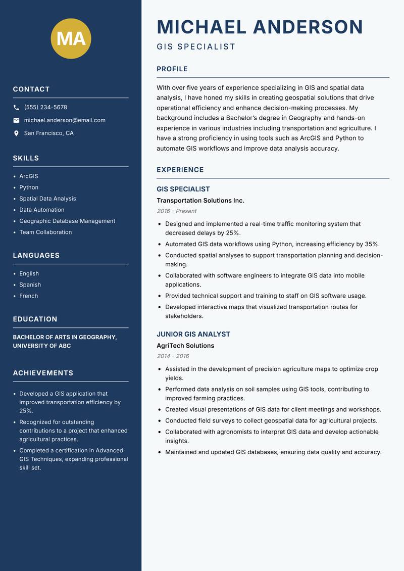
Classic Clean
Use Template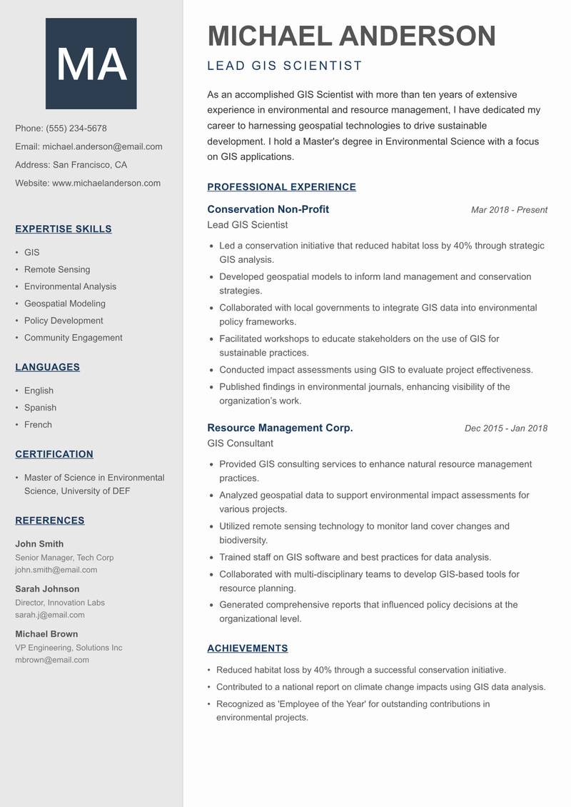
Creative Minimal
Use Template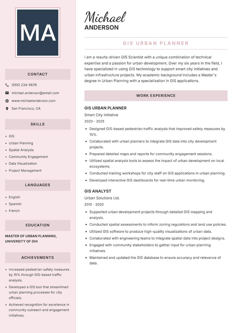
Executive
Use Template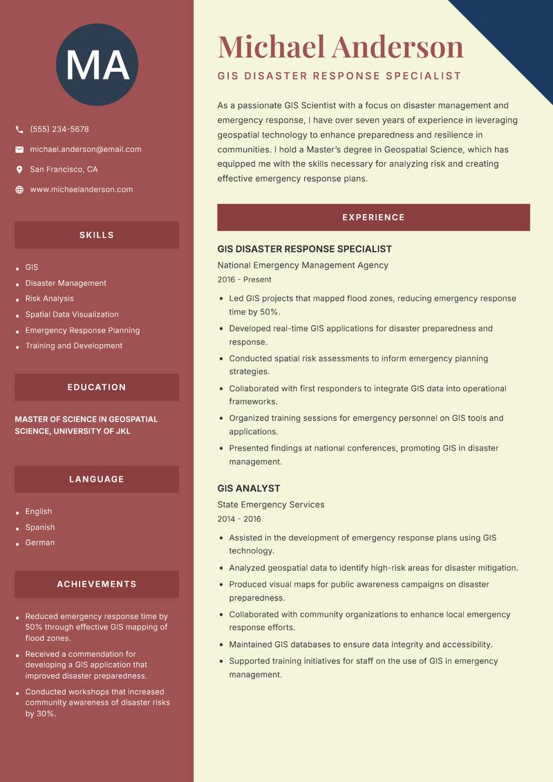
Two Column
Use Template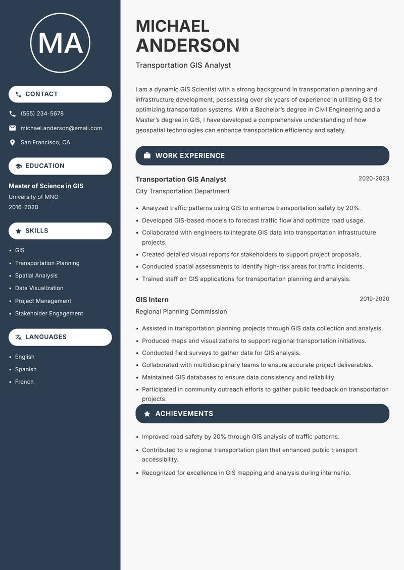
Compact
Use Template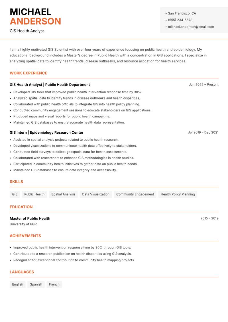
Modern Professional
Use Template7 Real GIS Scientist Resume Examples
Senior GIS Analyst with 8+ Years Experience
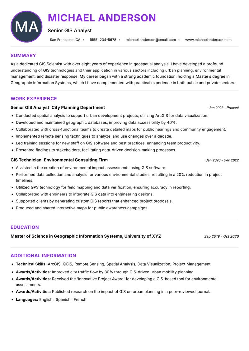
Summary: As a dedicated GIS Scientist with over eight years of experience in geospatial analysis, I have developed a profound understanding of GIS technologies and their application in various sectors including urban planning, environmental management, and disaster response. My career began with a strong academic foundation, holding a Master’s degree in Geographic Information Systems, which I have complemented with practical experience in both public and private sectors. My expertise includes advanced spatial analysis, remote sensing, and the integration of GIS with big data technologies. I am adept at using software such as ArcGIS and QGIS to create detailed maps and models that inform decision-making processes. One of my notable projects involved collaborating with city officials to develop a comprehensive urban mobility plan that improved traffic flow by 30%. I am passionate about leveraging geospatial data to solve real-world problems and enhance community resilience, while continuously seeking innovative solutions to enhance GIS capabilities in various projects.
Description:
- Conducted spatial analysis to support urban development projects, utilizing ArcGIS for data visualization.
- Developed and maintained geographic databases, improving data accessibility by 40%.
- Collaborated with cross-functional teams to create detailed maps for public hearings and community engagement.
- Implemented remote sensing techniques to analyze land use changes over a decade.
- Led training sessions for new staff on GIS software and best practices, enhancing team productivity.
- Presented findings to stakeholders, facilitating data-driven decision-making processes.
🏆 Key Achievements
GIS Specialist with 5+ Years Experience
Summary: With over five years of experience specializing in GIS and spatial data analysis, I have honed my skills in creating geospatial solutions that drive operational efficiency and enhance decision-making processes. My background includes a Bachelor’s degree in Geography and hands-on experience in various industries including transportation and agriculture. I have a strong proficiency in using tools such as ArcGIS and Python to automate GIS workflows and improve data analysis accuracy. My role at a leading transportation firm involved developing a real-time traffic monitoring system that reduced delays by 25%. I thrive in dynamic environments where I can apply my analytical skills to solve complex spatial problems, and I am committed to continuous learning to stay abreast of emerging GIS technologies that can benefit my projects.
Description:
- Designed and implemented a real-time traffic monitoring system that decreased delays by 25%.
- Automated GIS data workflows using Python, increasing efficiency by 35%.
- Conducted spatial analyses to support transportation planning and decision-making.
- Collaborated with software engineers to integrate GIS data into mobile applications.
- Provided technical support and training to staff on GIS software usage.
- Developed interactive maps that visualized transportation routes for stakeholders.
🏆 Key Achievements
Lead GIS Scientist with 10+ Years Experience
Summary: As an accomplished GIS Scientist with more than ten years of extensive experience in environmental and resource management, I have dedicated my career to harnessing geospatial technologies to drive sustainable development. I hold a Master's degree in Environmental Science with a focus on GIS applications. My expertise spans across various domains, including climate change analysis, land-use planning, and natural resource management, where I have successfully led projects that have resulted in significant environmental benefits. At a non-profit organization, I spearheaded a conservation initiative that reduced habitat loss by 40% through the meticulous use of GIS technology to inform land management decisions. I am passionate about using spatial data to empower communities and support effective policy-making that benefits both people and the planet.
Description:
- Led a conservation initiative that reduced habitat loss by 40% through strategic GIS analysis.
- Developed geospatial models to inform land management and conservation strategies.
- Collaborated with local governments to integrate GIS data into environmental policy frameworks.
- Facilitated workshops to educate stakeholders on the use of GIS for sustainable practices.
- Conducted impact assessments using GIS to evaluate project effectiveness.
- Published findings in environmental journals, enhancing visibility of the organization’s work.
🏆 Key Achievements
GIS Urban Planner with 6+ Years Experience
Summary: I am a results-driven GIS Scientist with a unique combination of technical expertise and a passion for urban development. Over my six years in the field, I have specialized in using GIS technology to support smart city initiatives and urban infrastructure projects. My academic background includes a Master's degree in Urban Planning with a specialization in GIS applications. I have developed a keen ability to analyze complex spatial data and present it in a way that is accessible to non-technical stakeholders. At my current role, I played a pivotal part in a city-wide initiative to map and analyze pedestrian traffic patterns, leading to a 15% increase in pedestrian safety measures. I am committed to leveraging GIS technologies to create sustainable urban environments and foster community engagement in the planning process.
Description:
- Designed GIS-based pedestrian traffic analysis that improved safety measures by 15%.
- Collaborated with urban planners to integrate GIS data into city development projects.
- Prepared detailed maps and reports for community engagement sessions.
- Utilized spatial analysis tools to assess the impact of urban development on local ecosystems.
- Conducted training workshops for city staff on GIS applications in urban planning.
- Developed interactive GIS dashboards for real-time urban monitoring.
🏆 Key Achievements
GIS Disaster Response Specialist with 7+ Years Experience
Summary: As a passionate GIS Scientist with a focus on disaster management and emergency response, I have over seven years of experience in leveraging geospatial technology to enhance preparedness and resilience in communities. I hold a Master’s degree in Geospatial Science, which has equipped me with the skills necessary for analyzing risk and creating effective emergency response plans. My work has included collaborations with government agencies to develop GIS applications that improve real-time disaster response capabilities. I successfully led a project that mapped flood zones, contributing to a 50% reduction in response time during emergencies. I am dedicated to using my expertise to help communities better prepare for and respond to disasters, ensuring that geospatial data is at the forefront of emergency planning and management.
Description:
- Led GIS projects that mapped flood zones, reducing emergency response time by 50%.
- Developed real-time GIS applications for disaster preparedness and response.
- Conducted spatial risk assessments to inform emergency planning strategies.
- Collaborated with first responders to integrate GIS data into operational frameworks.
- Organized training sessions for emergency personnel on GIS tools and applications.
- Presented findings at national conferences, promoting GIS in disaster management.
🏆 Key Achievements
Transportation GIS Analyst with 6+ Years Experience
Summary: I am a dynamic GIS Scientist with a strong background in transportation planning and infrastructure development, possessing over six years of experience in utilizing GIS for optimizing transportation systems. With a Bachelor’s degree in Civil Engineering and a Master’s degree in GIS, I have developed a comprehensive understanding of how geospatial technologies can enhance transportation efficiency and safety. My experience includes working with government agencies to analyze traffic patterns and develop infrastructure projects that have improved road safety by 20%. I am skilled in using various GIS software tools to conduct spatial analysis, create detailed reports, and visualize complex data sets. I am passionate about using GIS to drive innovations in transportation planning and contribute to sustainable urban mobility solutions.
Description:
- Analyzed traffic patterns using GIS to enhance transportation safety by 20%.
- Developed GIS-based models to forecast traffic flow and optimize road usage.
- Collaborated with engineers to integrate GIS data into transportation infrastructure projects.
- Created detailed visual reports for stakeholders to support project proposals.
- Conducted spatial assessments to identify high-risk areas for traffic incidents.
- Trained staff on GIS applications for transportation planning and analysis.
🏆 Key Achievements
GIS Health Analyst with 4+ Years Experience
Summary: I am a highly motivated GIS Scientist with over four years of experience focusing on public health and epidemiology. My educational background includes a Master’s degree in Public Health with a concentration in GIS applications. I specialize in analyzing spatial data to identify health trends, disease outbreaks, and resource allocation for health services. My role at a health department involved developing GIS tools that improved the response time of public health interventions by 30%. I am passionate about using my GIS expertise to contribute to public health initiatives and improve health outcomes in communities. I actively engage with stakeholders to promote the integration of GIS in health policy and planning.
Description:
- Developed GIS tools that improved public health intervention response time by 30%.
- Analyzed spatial data to identify trends in disease outbreaks and health disparities.
- Collaborated with public health officials to integrate GIS into health policy planning.
- Conducted community engagement sessions to educate stakeholders on GIS applications.
- Produced maps and visual reports for public health campaigns.
- Maintained GIS databases to ensure accurate health data representation.
🏆 Key Achievements
Key Skills for GIS Scientist
ATS Optimization Tips
Increase your chances of getting hired
Use Standard Headings
Use common section titles like Experience, Skills, etc.
Include Keywords
Add role-specific keywords from the job description
Keep it Simple
Avoid complex tables, images and graphics
Save in Right Format
Use PDF format unless otherwise specified
GIS Scientist Salary Insights
Average Salary
$90,000
per year
Salary Range
$70,000 - $110,000
per year
Top Paying Cities
Los Angeles, Seattle, Houston, Dallas, Boston
Source: Glassdoor, Payscale, Indeed (Updated April 2025)
Everything you need to write a great GIS Scientist resume
Strong Action Verbs to Use
Resume Writing Tips
- →Emphasize your hands-on experience with specific GIS software tools.
- →Highlight any projects where your analysis led to significant decisions or changes.
- →Include a section for technical skills that covers programming languages used for data manipulation, such as Python or R.
- →Showcase your collaborative efforts in multidisciplinary teams, as GIS often intersects with various fields.
- →Use quantifiable achievements to illustrate your impact, such as the number of projects completed or efficiency improvements.
Common Mistakes to Avoid
- ✕Listing general technical skills without specifying proficiency with relevant GIS software.
- ✕Failing to connect work experience directly to the impact on the projects or organizations.
- ✕Omitting relevant certifications that are standard in the GIS field.
- ✕Neglecting to describe the data sources and methodologies used in previous projects.
ATS Keywords for GIS Scientist
GIS Scientist Career Path
Relevant Certifications
Career Progression
Entry-Level GIS Technician
Focuses on data collection and entry; learns to use GIS software and tools.
GIS Analyst
Interprets spatial data, conducts analysis, and creates thematic maps for various sectors.
GIS Scientist
Integrates complex datasets to drive research projects and environmental assessments.
Senior GIS Scientist
Oversees project teams, develops advanced analysis models, and presents findings to stakeholders.
GIS Consultant/Manager
Provides expert advice and strategy on geospatial projects; manages client relationships and project budgets.
GIS Scientist Interview Questions
What GIS software are you most proficient in, and how have you used it in your past projects? +
Highlight specific projects where you utilized GIS software, detailing the tasks and outcomes.
Can you describe a complex map or model you developed and the process behind it? +
Include the story of the project, the data sources you integrated, and the impact it had.
How do you ensure accuracy and integrity in your geospatial datasets? +
Discuss methods like data validation techniques and checking source credibility.
What experience do you have with remote sensing technology, and how have you applied it in your work? +
Provide examples of projects that relied on satellite imagery or aerial data.
Tell us about a challenging project involving multi-layered geospatial data. How did you approach it? +
Focus on problem-solving and the strategies you implemented to overcome the challenges.
How do you communicate complex GIS data findings to non-technical stakeholders? +
Talk about your experience with presentations and simplifying technical information.
About the GIS Scientist Role
Through a refined understanding of geospatial information, a GIS Scientist devises innovative solutions to complex environmental challenges. This role encompasses not just mapping but also employing statistical models and predictive analytics to assess geographical phenomena. Collaboration with environmental scientists and urban planners ensures that analyses translate into actionable insights for sustainability and urban development projects.
Frequently Asked Questions
What programming languages should a GIS Scientist know? +
Python and R are widely used for data analysis, while SQL is essential for managing geodatabase systems.
Is fieldwork required for GIS Scientists? +
Fieldwork may be necessary, depending on the project, to collect data or validate GIS analyses in real-world environments.
What industries employ GIS Scientists? +
GIS Scientists find roles in environmental consulting, urban planning, disaster management, and resource management, among others.
How does a GIS Scientist stay current with technology trends? +
Engaging in continuous learning through online courses, certifications, and attending industry conferences is key.
What are common software tools used in GIS work? +
Common tools include ArcGIS, QGIS, and various remote sensing software applications.
More Resume Examples You Might Like
Related Career Paths
Other roles candidates for GIS Scientist positions often also consider.
Will this GIS Scientist resume pass the ATS scan?
Upload it and get an instant AI-scored compatibility check with specific fixes.
Check My Resume →
Pair it with a matching cover letter
AI drafts a first version from your job title and strengths — edit it live, then download the PDF.
Write My Cover Letter →
Written by Nohaya Career Team
Reviewed by HR Professionals · Updated April 2025
Ready to Build Your Perfect Resume?
Choose from 1000+ professional templates and land your dream job.
Create My Resume Now