Build an ATS-Friendly
Remote Sensing Scientist Resume
That Gets Interviews
A Remote Sensing Scientist analyzes data collected from satellite and aerial imagery to monitor environmental changes and support research in Earth sciences. The role heavily involves using specialized software for processing geospatial data and interpreting complex datasets. Often collaborating with…
Remote Sensing Scientist Resume Templates
Modern Professional
Use Template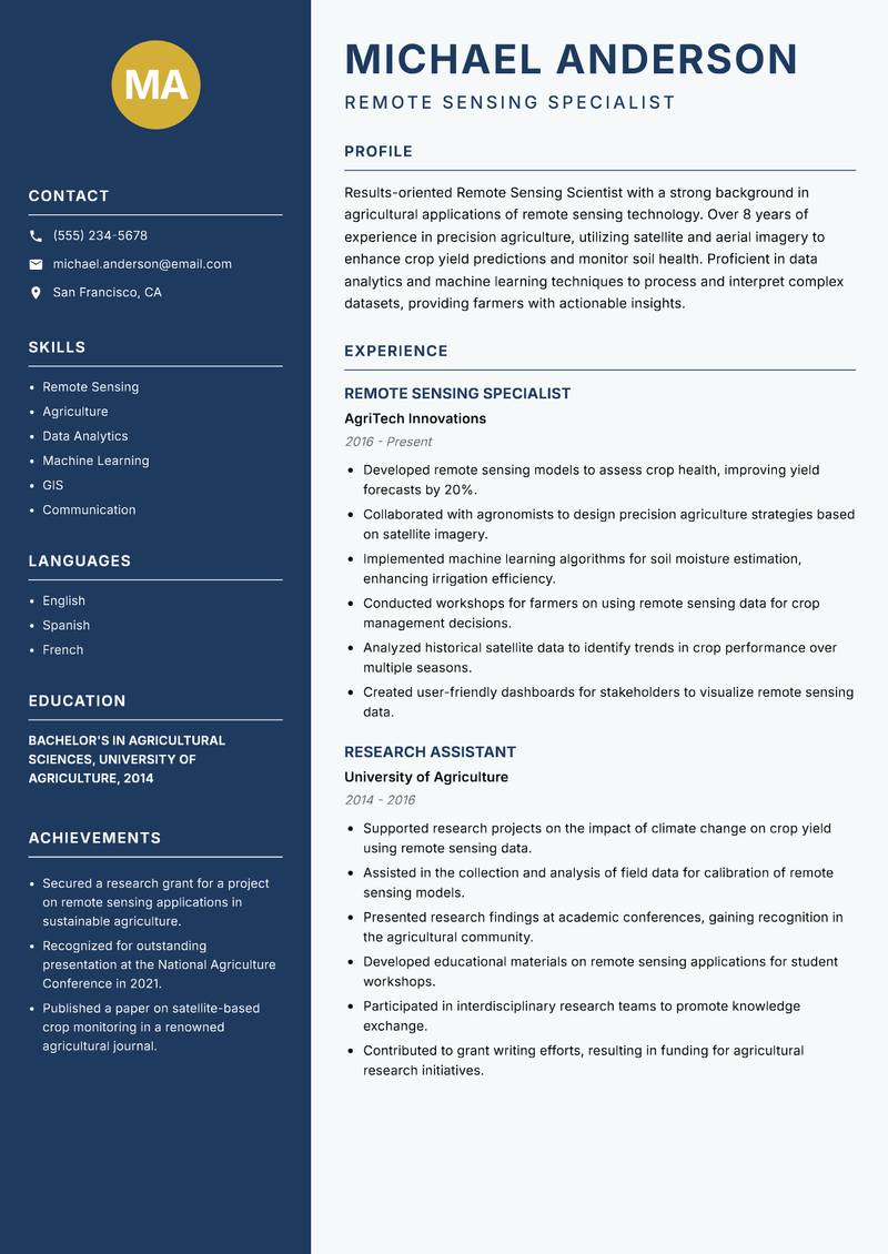
Classic Clean
Use Template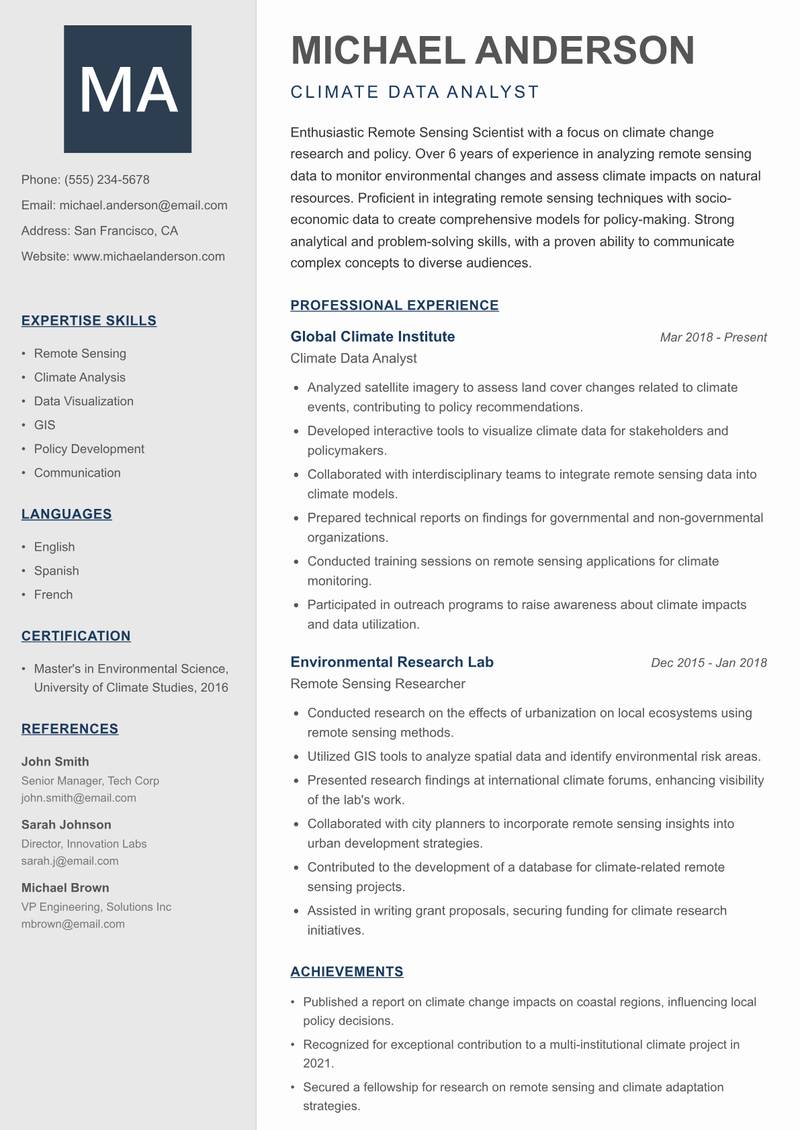
Creative Minimal
Use Template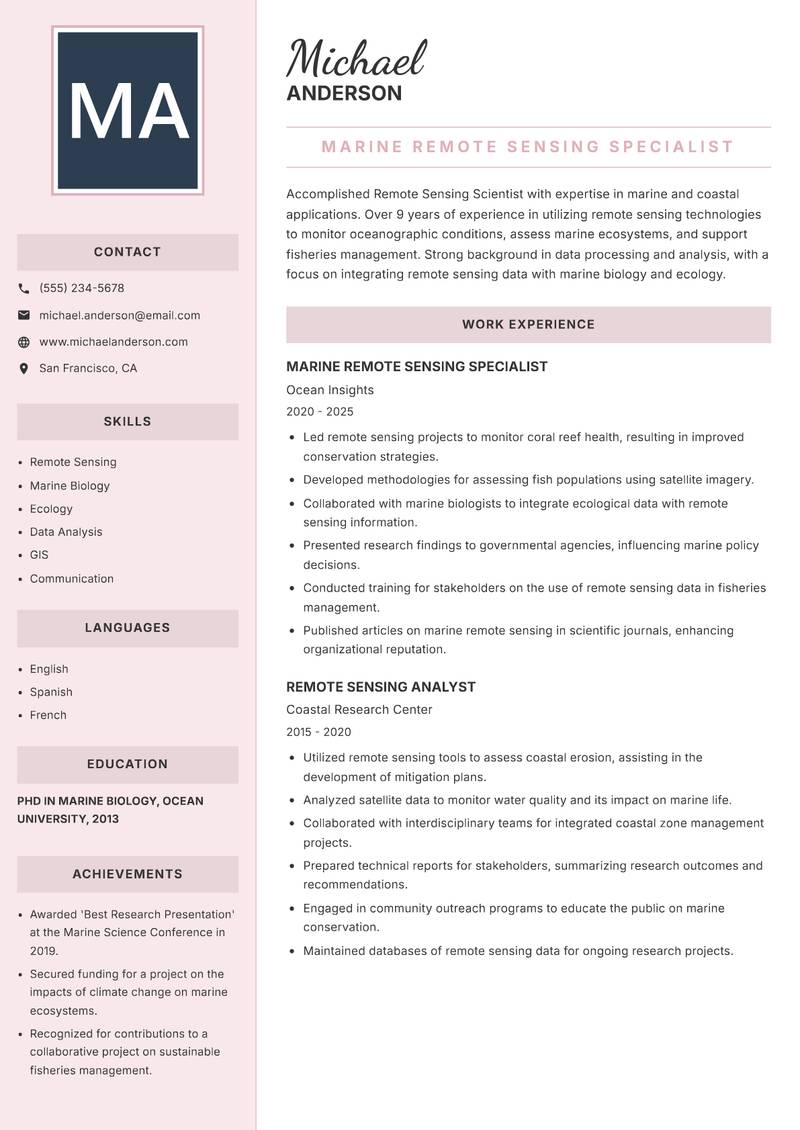
Executive
Use Template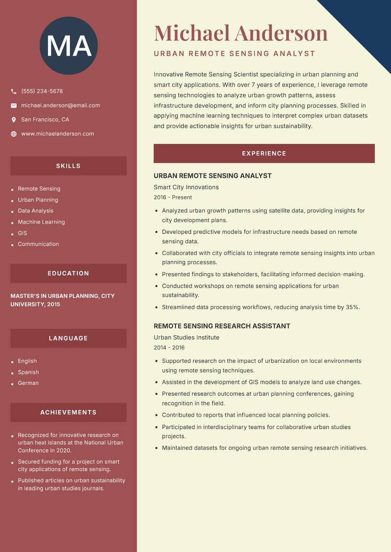
Two Column
Use Template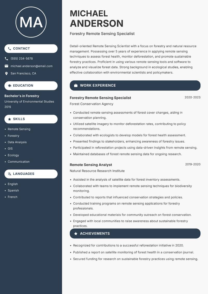
Compact
Use Template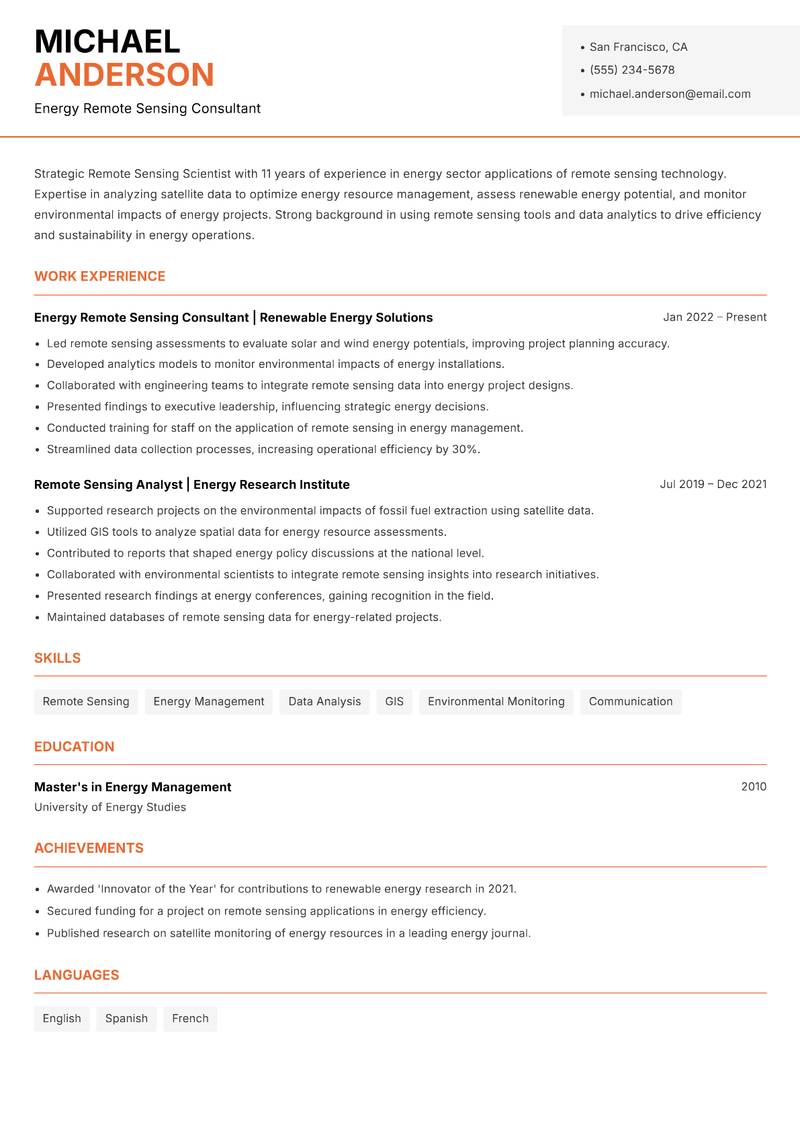
Modern Professional
Use Template7 Real Remote Sensing Scientist Resume Examples
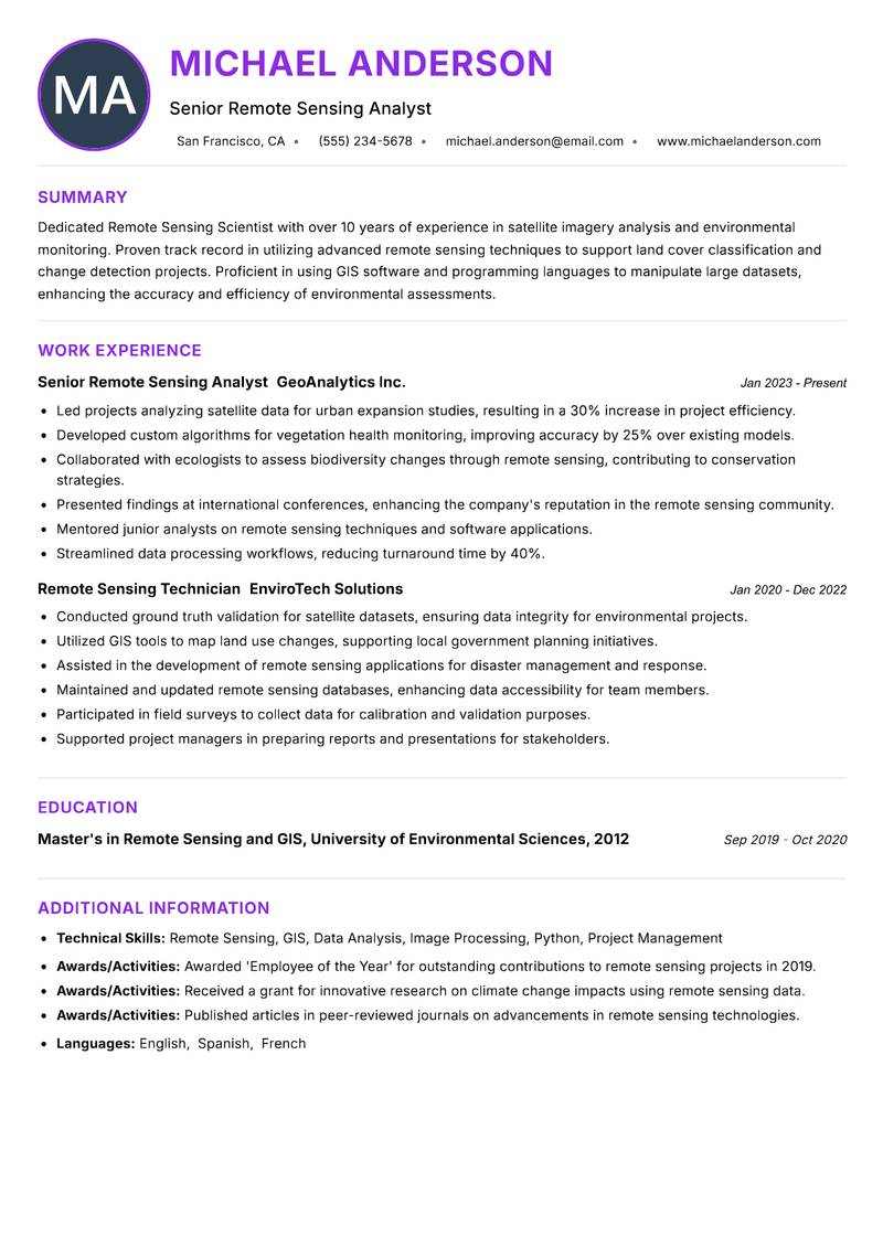
Senior Remote Sensing Analyst with 10+ Years Experience
Summary: Dedicated Remote Sensing Scientist with over 10 years of experience in satellite imagery analysis and environmental monitoring. Proven track record in utilizing advanced remote sensing techniques to support land cover classification and change detection projects. Proficient in using GIS software and programming languages to manipulate large datasets, enhancing the accuracy and efficiency of environmental assessments. Skilled in developing algorithms for image processing and integration of remote sensing data with ground truth information. Adept at collaborating with multidisciplinary teams to provide actionable insights for sustainable resource management. Committed to continuous learning and applying innovative technologies to improve remote sensing methodologies and outcomes.
Description:
- Led projects analyzing satellite data for urban expansion studies, resulting in a 30% increase in project efficiency.
- Developed custom algorithms for vegetation health monitoring, improving accuracy by 25% over existing models.
- Collaborated with ecologists to assess biodiversity changes through remote sensing, contributing to conservation strategies.
- Presented findings at international conferences, enhancing the company's reputation in the remote sensing community.
- Mentored junior analysts on remote sensing techniques and software applications.
- Streamlined data processing workflows, reducing turnaround time by 40%.
🏆 Key Achievements
Remote Sensing Specialist with 8+ Years Experience
Summary: Accomplished Remote Sensing Scientist with a strong background in agricultural applications of remote sensing technology. Over 8 years of experience in precision agriculture, utilizing satellite and aerial imagery to enhance crop yield predictions and monitor soil health. Proficient in data analytics and machine learning techniques to process and interpret complex datasets, providing farmers with actionable insights. Strong communication skills enable effective collaboration with agronomists and stakeholders to implement data-driven solutions. Passionate about integrating cutting-edge technology in agriculture to promote sustainable practices and increase food security.
Description:
- Developed remote sensing models to assess crop health, improving yield forecasts by 20%.
- Collaborated with agronomists to design precision agriculture strategies based on satellite imagery.
- Implemented machine learning algorithms for soil moisture estimation, enhancing irrigation efficiency.
- Conducted workshops for farmers on using remote sensing data for crop management decisions.
- Analyzed historical satellite data to identify trends in crop performance over multiple seasons.
- Created user-friendly dashboards for stakeholders to visualize remote sensing data.
🏆 Key Achievements
Climate Data Analyst with 6+ Years Experience
Summary: Enthusiastic Remote Sensing Scientist with a focus on climate change research and policy. Over 6 years of experience in analyzing remote sensing data to monitor environmental changes and assess climate impacts on natural resources. Proficient in integrating remote sensing techniques with socio-economic data to create comprehensive models for policy-making. Strong analytical and problem-solving skills, with a proven ability to communicate complex concepts to diverse audiences. Committed to leveraging remote sensing technology to inform sustainable development and climate resilience strategies.
Description:
- Analyzed satellite imagery to assess land cover changes related to climate events, contributing to policy recommendations.
- Developed interactive tools to visualize climate data for stakeholders and policymakers.
- Collaborated with interdisciplinary teams to integrate remote sensing data into climate models.
- Prepared technical reports on findings for governmental and non-governmental organizations.
- Conducted training sessions on remote sensing applications for climate monitoring.
- Participated in outreach programs to raise awareness about climate impacts and data utilization.
🏆 Key Achievements
Marine Remote Sensing Specialist with 9+ Years Experience
Summary: Accomplished Remote Sensing Scientist with expertise in marine and coastal applications. Over 9 years of experience in utilizing remote sensing technologies to monitor oceanographic conditions, assess marine ecosystems, and support fisheries management. Strong background in data processing and analysis, with a focus on integrating remote sensing data with marine biology and ecology. Proven ability to lead research projects that have influenced policy and conservation efforts. Passionate about using technology to support sustainable practices in marine environments and advocate for ocean conservation.
Description:
- Led remote sensing projects to monitor coral reef health, resulting in improved conservation strategies.
- Developed methodologies for assessing fish populations using satellite imagery.
- Collaborated with marine biologists to integrate ecological data with remote sensing information.
- Presented research findings to governmental agencies, influencing marine policy decisions.
- Conducted training for stakeholders on the use of remote sensing data in fisheries management.
- Published articles on marine remote sensing in scientific journals, enhancing organizational reputation.
🏆 Key Achievements
Urban Remote Sensing Analyst with 7+ Years Experience
Summary: Innovative Remote Sensing Scientist specializing in urban planning and smart city applications. With over 7 years of experience, I leverage remote sensing technologies to analyze urban growth patterns, assess infrastructure development, and inform city planning processes. Skilled in applying machine learning techniques to interpret complex urban datasets and provide actionable insights for urban sustainability. Strong communicator with the ability to translate technical findings into strategic recommendations for city officials and stakeholders. Committed to using technology to foster sustainable urban development and enhance the quality of life in cities.
Description:
- Analyzed urban growth patterns using satellite data, providing insights for city development plans.
- Developed predictive models for infrastructure needs based on remote sensing data.
- Collaborated with city officials to integrate remote sensing insights into urban planning processes.
- Presented findings to stakeholders, facilitating informed decision-making.
- Conducted workshops on remote sensing applications for urban sustainability.
- Streamlined data processing workflows, reducing analysis time by 35%.
🏆 Key Achievements
Forestry Remote Sensing Specialist with 5+ Years Experience
Summary: Detail-oriented Remote Sensing Scientist with a focus on forestry and natural resource management. Possessing over 5 years of experience in applying remote sensing techniques to assess forest health, monitor deforestation, and promote sustainable forestry practices. Proficient in using various remote sensing tools and software to analyze and visualize forest data. Strong background in ecological studies, enabling effective collaboration with environmental scientists and policymakers. Passionate about utilizing technology to support conservation efforts and sustainable management of forest resources.
Description:
- Conducted remote sensing assessments of forest cover changes, aiding in conservation planning.
- Utilized satellite imagery to monitor deforestation rates, contributing to policy recommendations.
- Collaborated with ecologists to develop models for forest health assessment.
- Presented findings to stakeholders, enhancing awareness of forestry issues.
- Participated in reforestation projects using data-driven insights from remote sensing.
- Maintained databases of forest remote sensing data for ongoing research.
🏆 Key Achievements
Energy Remote Sensing Consultant with 11+ Years Experience
Summary: Strategic Remote Sensing Scientist with 11 years of experience in energy sector applications of remote sensing technology. Expertise in analyzing satellite data to optimize energy resource management, assess renewable energy potential, and monitor environmental impacts of energy projects. Strong background in using remote sensing tools and data analytics to drive efficiency and sustainability in energy operations. Proven ability to collaborate with engineers and policymakers to develop data-driven strategies for energy management. Passionate about leveraging technology to support the transition to sustainable energy systems.
Description:
- Led remote sensing assessments to evaluate solar and wind energy potentials, improving project planning accuracy.
- Developed analytics models to monitor environmental impacts of energy installations.
- Collaborated with engineering teams to integrate remote sensing data into energy project designs.
- Presented findings to executive leadership, influencing strategic energy decisions.
- Conducted training for staff on the application of remote sensing in energy management.
- Streamlined data collection processes, increasing operational efficiency by 30%.
🏆 Key Achievements
Key Skills for Remote Sensing Scientist
ATS Optimization Tips
Increase your chances of getting hired
Use Standard Headings
Use common section titles like Experience, Skills, etc.
Include Keywords
Add role-specific keywords from the job description
Keep it Simple
Avoid complex tables, images and graphics
Save in Right Format
Use PDF format unless otherwise specified
Remote Sensing Scientist Salary Insights
Average Salary
$95,000
per year
Salary Range
$70,000 - $120,000
per year
Top Paying Cities
Los Angeles, Seattle, Houston, Dallas, Boston
Source: Glassdoor, Payscale, Indeed (Updated April 2025)
Everything you need to write a great Remote Sensing Scientist resume
Strong Action Verbs to Use
Resume Writing Tips
- →Include specific remote sensing projects you've worked on, emphasizing the impact of your contributions.
- →Highlight software proficiency in tools such as ENVI, ERDAS Imagine, or Google Earth Engine.
- →Showcase interdisciplinary collaborations that illustrate your ability to work in diverse teams.
- →Mention any relevant fieldwork experiences, especially those involving data collection.
- →Use quantifiable achievements to demonstrate the impact of your analyses on real-world projects.
- →Highlight your adaptability with emerging technologies in remote sensing.
Common Mistakes to Avoid
- ✕Listing generic software skills instead of specifying remote sensing software expertise.
- ✕Providing overly technical jargon that may confuse reviewers without a technical background.
- ✕Neglecting to highlight teamwork and communication skills, which are crucial in interdisciplinary projects.
- ✕Omitting the context or objectives behind your projects, making it hard to assess their significance.
- ✕Failing to tailor your resume for specific job applications by using generic descriptions.
ATS Keywords for Remote Sensing Scientist
Remote Sensing Scientist Career Path
Relevant Certifications
Career Progression
Entry-Level Remote Sensing Scientist
Focuses on data collection and initial analysis, often collaborating with senior scientists on specific projects.
Mid-Level Remote Sensing Scientist
Leads smaller projects and analyzes complex datasets, often utilizing specialized software for image processing.
Senior Remote Sensing Scientist
Oversees multiple projects, mentors junior staff, and is responsible for high-level analysis and reporting.
Research Director
Manages research initiatives, forms strategic partnerships, and coordinates large-scale studies within the Earth sciences community.
Consulting Expert
Provides expert guidance to government and industry-focused projects related to remote sensing technologies and applications.
Remote Sensing Scientist Interview Questions
What remote sensing platforms and technologies have you worked with? +
Be specific about satellite missions, UAVs, and any ground-based sensors.
How do you approach the analysis of satellite data for environmental studies? +
Discuss your methodology, tools, and the types of conclusions you've drawn.
Can you detail a project where you significantly improved data accuracy? +
Highlight your specific actions, tools used, and the impact of the project.
What role does GIS play in your remote sensing projects? +
Explain the integration of GIS technologies and how they complement remote sensing.
Describe a challenge you faced in data interpretation and how you resolved it. +
Focus on problem-solving abilities and technical skills.
How do you keep up with advancements in remote sensing technologies? +
Mention specific journals, conferences, or online communities.
Can you give an example of a time when you had to present technical findings to a non-technical audience? +
Discuss communication strategies and visualization techniques.
About the Remote Sensing Scientist Role
A Remote Sensing Scientist analyzes data collected from satellite and aerial imagery to monitor environmental changes and support research in Earth sciences. The role heavily involves using specialized software for processing geospatial data and interpreting complex datasets. Often collaborating with cross-disciplinary teams, Remote Sensing Scientists provide insights that inform conservation efforts, urban planning, and disaster response strategies.
Frequently Asked Questions
What programming languages are most useful for a Remote Sensing Scientist? +
Python and R are highly relevant, especially for data manipulation and analysis.
Are fieldwork experiences important for this role? +
Yes, practical experience in collecting data is essential to understand the data's context.
What industries employ Remote Sensing Scientists? +
They work in environmental consulting, government agencies, academia, agriculture, and disaster management.
What is the future job outlook for Remote Sensing Scientists? +
With the increasing demand for big data and environmental monitoring, the outlook is positive.
What type of degree is typically required for this role? +
A bachelor's degree in Earth sciences, geography, remote sensing, or a related field is usually required, with advanced degrees preferred.
More Resume Examples You Might Like
Related Career Paths
Other roles candidates for Remote Sensing Scientist positions often also consider.
Will this Remote Sensing Scientist resume pass the ATS scan?
Upload it and get an instant AI-scored compatibility check with specific fixes.
Check My Resume →
Pair it with a matching cover letter
AI drafts a first version from your job title and strengths — edit it live, then download the PDF.
Write My Cover Letter →
Written by Nohaya Career Team
Reviewed by HR Professionals · Updated April 2025
Ready to Build Your Perfect Resume?
Choose from 1000+ professional templates and land your dream job.
Create My Resume Now