Build an ATS-Friendly
Remote Sensing Forestry Specialist Resume
That Gets Interviews
The Remote Sensing Forestry Specialist utilizes advanced remote sensing technology to gather and analyze data related to forestry resources and ecosystems. This role focuses on assessing forest cover, health, and changes over time through the interpretation of satellite imagery and aerial data. Collaborating with…
Remote Sensing Forestry Specialist Resume Templates
Modern Professional
Use Template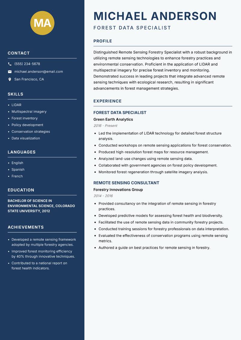
Classic Clean
Use Template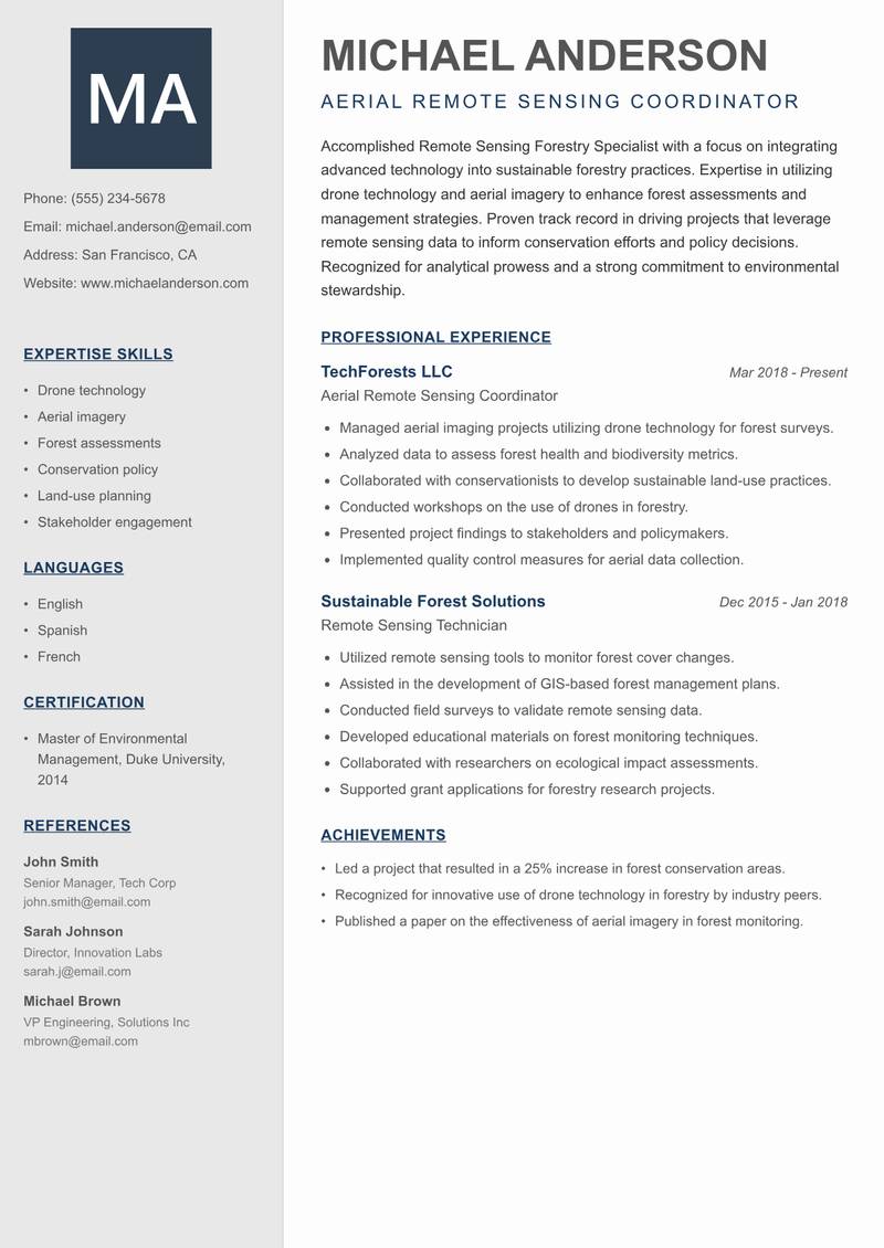
Creative Minimal
Use Template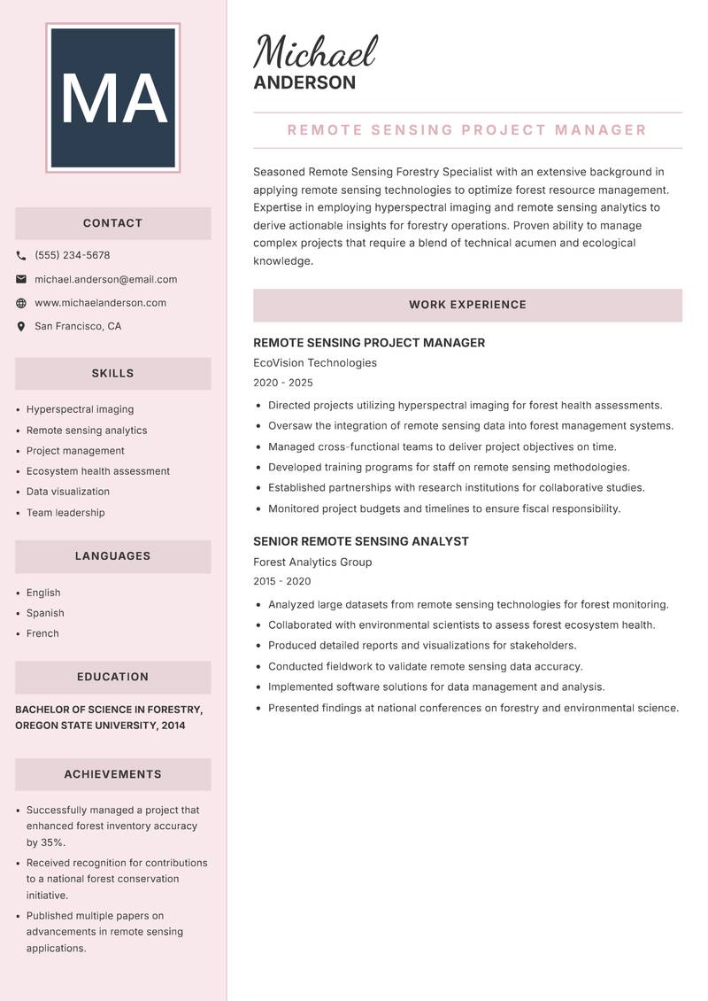
Executive
Use Template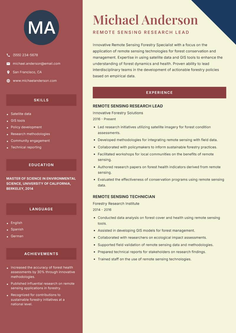
Two Column
Use Template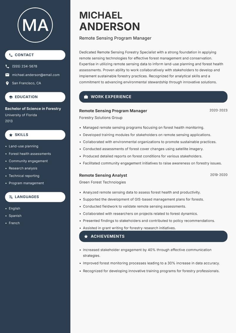
Compact
Use Template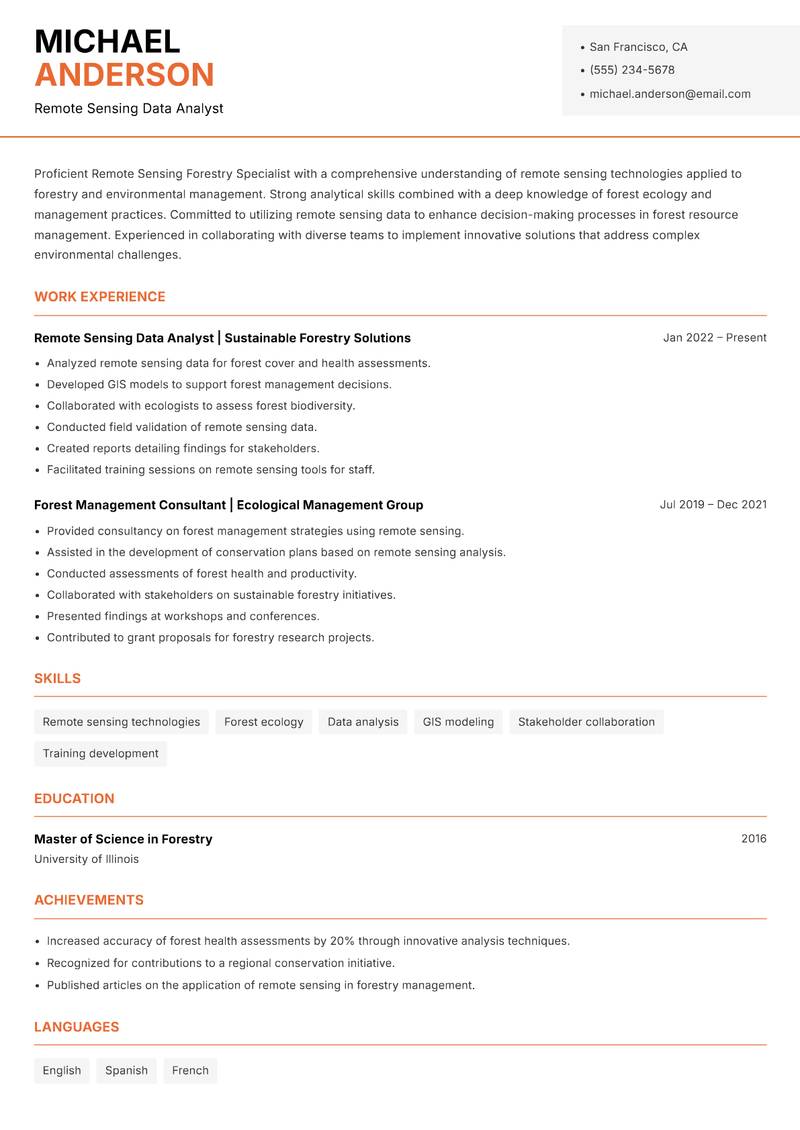
Modern Professional
Use Template7 Real Remote Sensing Forestry Specialist Resume Examples
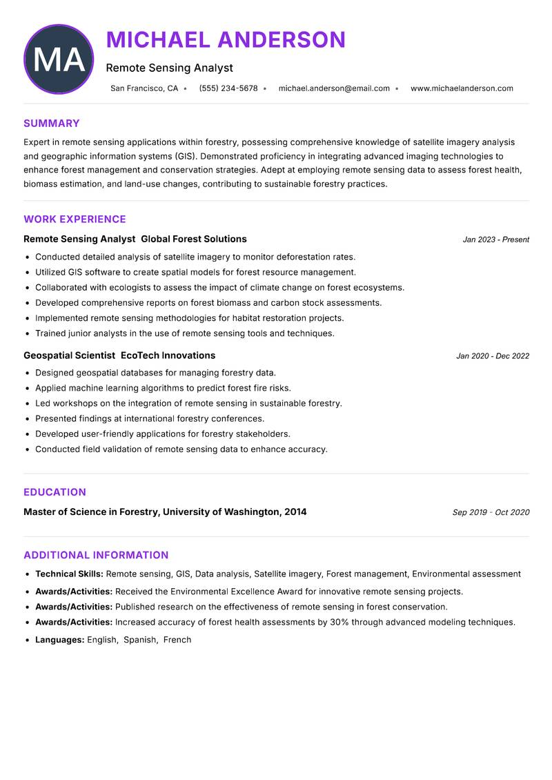
Remote Sensing Analyst with 8+ Years Experience
Summary: Expert in remote sensing applications within forestry, possessing comprehensive knowledge of satellite imagery analysis and geographic information systems (GIS). Demonstrated proficiency in integrating advanced imaging technologies to enhance forest management and conservation strategies. Adept at employing remote sensing data to assess forest health, biomass estimation, and land-use changes, contributing to sustainable forestry practices. Proven ability to collaborate with multidisciplinary teams to develop innovative solutions that address environmental challenges. Strong analytical skills complemented by a solid foundation in ecological principles and forest dynamics. Committed to advancing the field of forestry through research and application of cutting-edge technology.
Description:
- Conducted detailed analysis of satellite imagery to monitor deforestation rates.
- Utilized GIS software to create spatial models for forest resource management.
- Collaborated with ecologists to assess the impact of climate change on forest ecosystems.
- Developed comprehensive reports on forest biomass and carbon stock assessments.
- Implemented remote sensing methodologies for habitat restoration projects.
- Trained junior analysts in the use of remote sensing tools and techniques.
🏆 Key Achievements
Forest Data Specialist with 10+ Years Experience
Summary: Distinguished Remote Sensing Forestry Specialist with a robust background in utilizing remote sensing technologies to enhance forestry practices and environmental conservation. Proficient in the application of LIDAR and multispectral imagery for precise forest inventory and monitoring. Demonstrated success in leading projects that integrate advanced remote sensing techniques with ecological research, resulting in significant advancements in forest management strategies. Possesses extensive experience in collaborating with stakeholders to promote sustainable forestry initiatives. Recognized for a keen analytical mindset and the ability to translate complex data into actionable insights for policy development and implementation.
Description:
- Led the implementation of LIDAR technology for detailed forest structure analysis.
- Conducted workshops on remote sensing applications for forest conservation.
- Produced high-resolution forest maps for resource management.
- Analyzed land-use changes using remote sensing data.
- Collaborated with government agencies on forest policy development.
- Monitored forest regeneration through satellite imagery analysis.
🏆 Key Achievements
Aerial Remote Sensing Coordinator with 8+ Years Experience
Summary: Accomplished Remote Sensing Forestry Specialist with a focus on integrating advanced technology into sustainable forestry practices. Expertise in utilizing drone technology and aerial imagery to enhance forest assessments and management strategies. Proven track record in driving projects that leverage remote sensing data to inform conservation efforts and policy decisions. Recognized for analytical prowess and a strong commitment to environmental stewardship. Demonstrated ability to work collaboratively with diverse stakeholders, including governmental agencies, NGOs, and local communities, to promote sustainable land-use practices. Passionate about advancing the role of technology in forestry through innovative solutions.
Description:
- Managed aerial imaging projects utilizing drone technology for forest surveys.
- Analyzed data to assess forest health and biodiversity metrics.
- Collaborated with conservationists to develop sustainable land-use practices.
- Conducted workshops on the use of drones in forestry.
- Presented project findings to stakeholders and policymakers.
- Implemented quality control measures for aerial data collection.
🏆 Key Achievements
Remote Sensing Project Manager with 8+ Years Experience
Summary: Seasoned Remote Sensing Forestry Specialist with an extensive background in applying remote sensing technologies to optimize forest resource management. Expertise in employing hyperspectral imaging and remote sensing analytics to derive actionable insights for forestry operations. Proven ability to manage complex projects that require a blend of technical acumen and ecological knowledge. Recognized for a strong commitment to advancing sustainable forestry practices through innovative solutions. Experienced in collaborating with governmental and non-governmental organizations to ensure the effective implementation of forestry initiatives. Possesses a comprehensive understanding of forest ecosystems and their dynamics.
Description:
- Directed projects utilizing hyperspectral imaging for forest health assessments.
- Oversaw the integration of remote sensing data into forest management systems.
- Managed cross-functional teams to deliver project objectives on time.
- Developed training programs for staff on remote sensing methodologies.
- Established partnerships with research institutions for collaborative studies.
- Monitored project budgets and timelines to ensure fiscal responsibility.
🏆 Key Achievements
Remote Sensing Research Lead with 8+ Years Experience
Summary: Innovative Remote Sensing Forestry Specialist with a focus on the application of remote sensing technologies for forest conservation and management. Expertise in using satellite data and GIS tools to enhance the understanding of forest dynamics and health. Proven ability to lead interdisciplinary teams in the development of actionable forestry policies based on empirical data. Recognized for exceptional problem-solving skills and a commitment to integrating technology with ecological principles for sustainable outcomes. Experienced in working with diverse stakeholders to promote awareness and adoption of remote sensing techniques in forestry practices. Passionate about leveraging technology to foster sustainable forest management strategies.
Description:
- Led research initiatives utilizing satellite imagery for forest condition assessments.
- Developed methodologies for integrating remote sensing with field data.
- Collaborated with policymakers to inform sustainable forestry practices.
- Facilitated workshops for local communities on the benefits of remote sensing.
- Authored research papers on forest health indicators derived from remote sensing.
- Evaluated the effectiveness of conservation programs using remote sensing data.
🏆 Key Achievements
Remote Sensing Program Manager with 8+ Years Experience
Summary: Dedicated Remote Sensing Forestry Specialist with a strong foundation in applying remote sensing technologies for effective forest management and conservation. Expertise in utilizing remote sensing data to inform land-use planning and forest health assessments. Proven ability to work collaboratively with stakeholders to develop and implement sustainable forestry practices. Recognized for analytical skills and a commitment to advancing environmental stewardship through innovative solutions. Experienced in conducting research and providing training on remote sensing applications to enhance forest management strategies. Passionate about leveraging technology to promote sustainable forestry initiatives.
Description:
- Managed remote sensing programs focusing on forest health monitoring.
- Developed training modules for stakeholders on remote sensing applications.
- Collaborated with environmental organizations to promote sustainable practices.
- Conducted assessments of forest cover changes using satellite imagery.
- Produced detailed reports on forest conditions for various stakeholders.
- Facilitated community engagement initiatives to raise awareness on forestry issues.
🏆 Key Achievements
Remote Sensing Data Analyst with 8+ Years Experience
Summary: Proficient Remote Sensing Forestry Specialist with a comprehensive understanding of remote sensing technologies applied to forestry and environmental management. Strong analytical skills combined with a deep knowledge of forest ecology and management practices. Committed to utilizing remote sensing data to enhance decision-making processes in forest resource management. Experienced in collaborating with diverse teams to implement innovative solutions that address complex environmental challenges. Recognized for a detail-oriented approach and the ability to translate technical data into practical applications for forestry operations. Enthusiastic about advancing sustainable forestry practices through the integration of technology.
Description:
- Analyzed remote sensing data for forest cover and health assessments.
- Developed GIS models to support forest management decisions.
- Collaborated with ecologists to assess forest biodiversity.
- Conducted field validation of remote sensing data.
- Created reports detailing findings for stakeholders.
- Facilitated training sessions on remote sensing tools for staff.
🏆 Key Achievements
Key Skills for Remote Sensing Forestry Specialist
ATS Optimization Tips
Increase your chances of getting hired
Use Standard Headings
Use common section titles like Experience, Skills, etc.
Include Keywords
Add role-specific keywords from the job description
Keep it Simple
Avoid complex tables, images and graphics
Save in Right Format
Use PDF format unless otherwise specified
Remote Sensing Forestry Specialist Salary Insights
Average Salary
$77,500
per year
Salary Range
$60,000 - $95,000
per year
Top Paying Cities
Los Angeles, Seattle, Houston, Dallas, Boston
Source: Glassdoor, Payscale, Indeed (Updated August 2025)
Everything you need to write a great Remote Sensing Forestry Specialist resume
Strong Action Verbs to Use
Resume Writing Tips
- →Highlight experience with specific remote sensing software, such as ENVI or ERDAS Imagine.
- →Showcase projects where remote sensing has led to tangible improvements in forestry practices.
- →Include any collaborative work with environmental regulatory bodies or NGOs in your resume.
- →Use quantifiable metrics to illustrate the impact of your work on forests or ecosystems.
- →Emphasize interdisciplinary skills, such as merging data from biology, ecology, and technology.
Common Mistakes to Avoid
- ✕Listing generic remote sensing skills without detailing specific applications in forestry.
- ✕Failing to mention teamwork or collaboration in projects related to forestry management.
- ✕Including outdated certifications or neglecting to update technological proficiencies.
- ✕Omitting the importance of field data validation in remote sensing analysis.
ATS Keywords for Remote Sensing Forestry Specialist
Remote Sensing Forestry Specialist Career Path
Relevant Certifications
Career Progression
Entry-Level Remote Sensing Technician
Assist in data collection and processing for forestry projects using remote sensing technology.
Remote Sensing Analyst
Analyze satellite imagery and GIS data to assess forest health and land use patterns.
Senior Remote Sensing Forestry Specialist
Lead complex projects, collaborate with environmental scientists, and provide expert analysis on forestry issues.
Project Manager, Remote Sensing
Oversee multiple remote sensing projects, manage budgets, and ensure delivery of results to stakeholders.
Consultant in Forestry Remote Sensing
Advise organizations on remote sensing methods, applications, and technology advancements in forestry.
Remote Sensing Forestry Specialist Interview Questions
What remote sensing technologies do you have experience with? +
Discuss specific software and satellite systems you are proficient in.
Can you explain how you analyze satellite imagery for forestry health assessments? +
Detail your analytical process and tools used.
How do you handle inaccuracies in remote sensing data? +
Share a method you've used to validate or correct such data.
Describe a project where you used GIS to solve a forestry-related problem. +
Provide specifics about the problem, your approach, and the outcome.
What challenges do you face when integrating remote sensing data with field data? +
Talk about compatibility issues or data discrepancies you've encountered.
How do you stay up to date with advancements in remote sensing technology? +
Mention any resources, courses, or professional networks you engage with.
About the Remote Sensing Forestry Specialist Role
The Remote Sensing Forestry Specialist utilizes advanced remote sensing technology to gather and analyze data related to forestry resources and ecosystems. This role focuses on assessing forest cover, health, and changes over time through the interpretation of satellite imagery and aerial data. Collaborating with forestry scientists and land management agencies, individuals in this position contribute critical data to support sustainable forest management and policy decisions.
Frequently Asked Questions
What is the primary focus of a Remote Sensing Forestry Specialist? +
This role centers on utilizing remote sensing technologies to monitor and manage forest ecosystems effectively.
What educational background is typically required for this position? +
A degree in forestry, environmental sciences, geospatial technology, or a related field is generally necessary.
How does remote sensing enhance forest management practices? +
It allows for large-scale monitoring of forests, providing critical data for decision-making and resource management.
What industries employ Remote Sensing Forestry Specialists? +
They are commonly found in governmental agencies, environmental consultancies, research institutions, and NGOs focused on conservation.
What advancements in technology are impacting this field? +
Drones, improved satellite systems, and sophisticated GIS software are significantly enhancing the capabilities of remote sensing.
More Resume Examples You Might Like
Related Career Paths
Other roles candidates for Remote Sensing Forestry Specialist positions often also consider.
Will this Remote Sensing Forestry Specialist resume pass the ATS scan?
Upload it and get an instant AI-scored compatibility check with specific fixes.
Check My Resume →
Pair it with a matching cover letter
AI drafts a first version from your job title and strengths — edit it live, then download the PDF.
Write My Cover Letter →
Written by Nohaya Career Team
Reviewed by HR Professionals · Updated August 2025
Ready to Build Your Perfect Resume?
Choose from 1000+ professional templates and land your dream job.
Create My Resume Now