Build an ATS-Friendly
Land Information Systems Manager Resume
That Gets Interviews
Strategic oversight for land information systems entails developing and deploying advanced geographic information systems to support land administration objectives. The Land Information Systems Manager navigates cross-departmental collaborations to ensure the effective use of geospatial data in decision-making.…
Land Information Systems Manager Resume Templates
Modern Professional
Use Template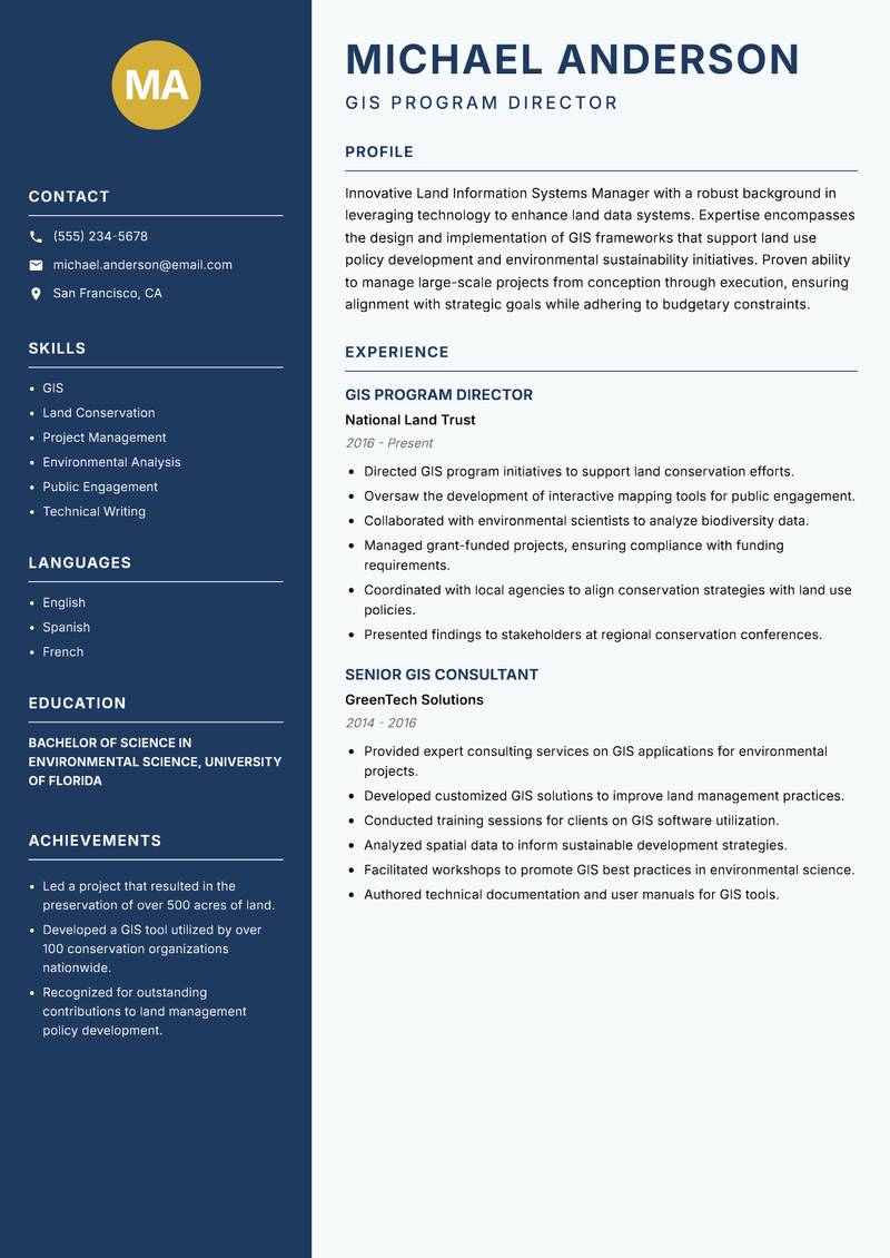
Classic Clean
Use Template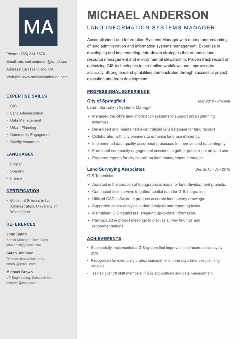
Creative Minimal
Use Template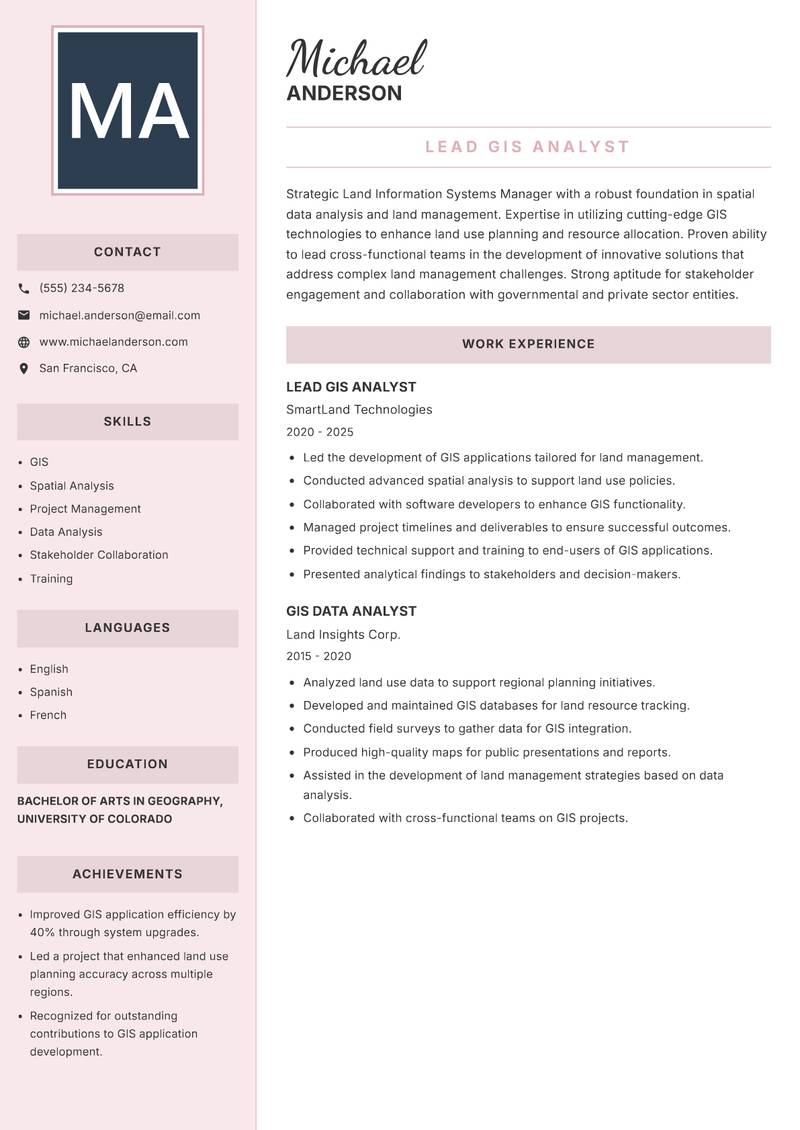
Executive
Use Template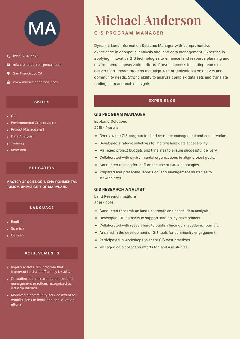
Two Column
Use Template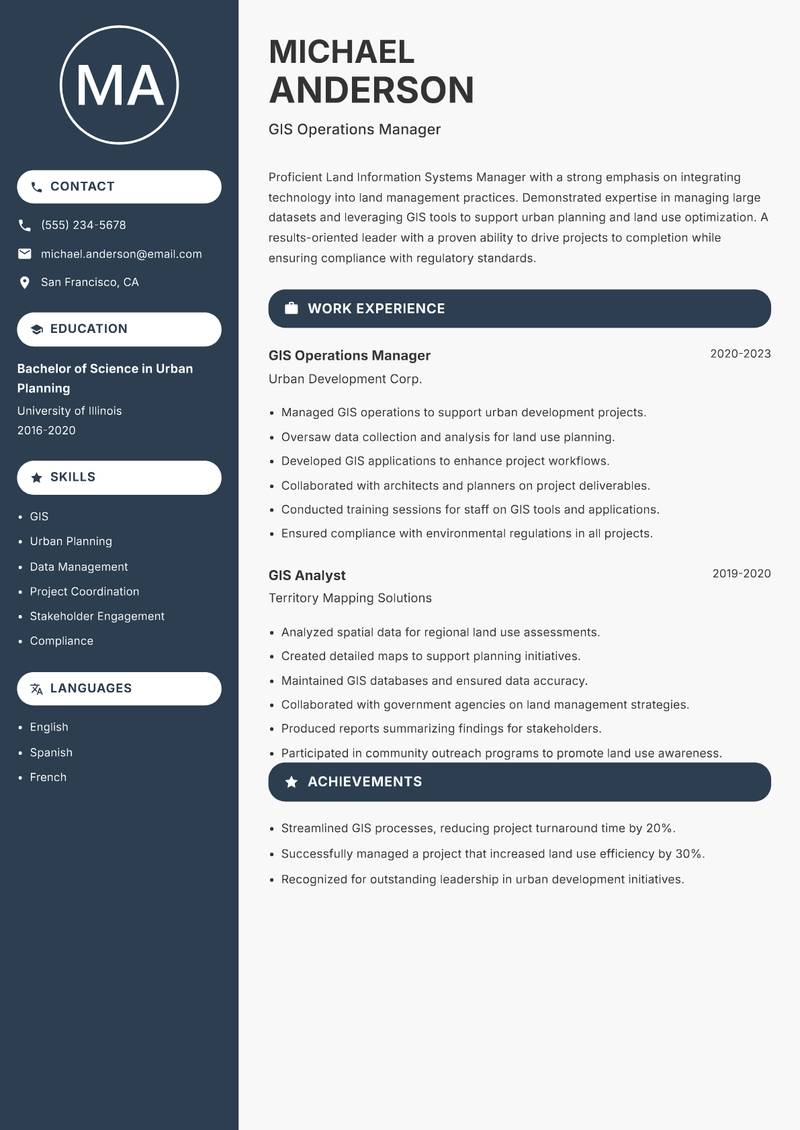
Compact
Use Template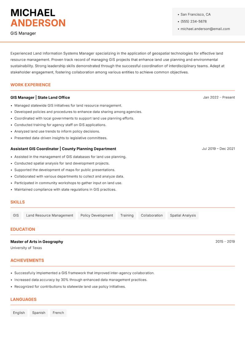
Modern Professional
Use Template7 Real Land Information Systems Manager Resume Examples
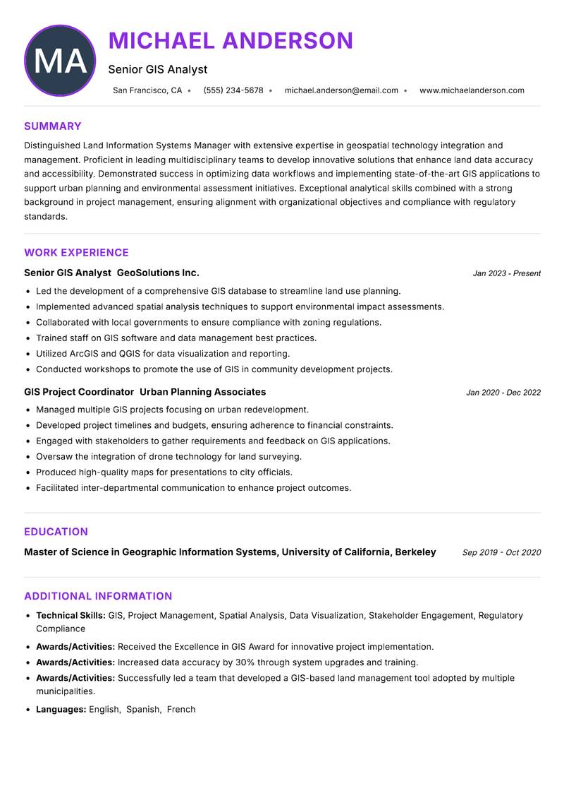
Senior GIS Analyst with 5+ Years Experience
Summary: Distinguished Land Information Systems Manager with extensive expertise in geospatial technology integration and management. Proficient in leading multidisciplinary teams to develop innovative solutions that enhance land data accuracy and accessibility. Demonstrated success in optimizing data workflows and implementing state-of-the-art GIS applications to support urban planning and environmental assessment initiatives. Exceptional analytical skills combined with a strong background in project management, ensuring alignment with organizational objectives and compliance with regulatory standards. A strategic thinker with a proven ability to foster stakeholder engagement and drive collaborative efforts across departments. Committed to advancing the field of land information management through continuous professional development and knowledge sharing within the community.
Description:
- Led the development of a comprehensive GIS database to streamline land use planning.
- Implemented advanced spatial analysis techniques to support environmental impact assessments.
- Collaborated with local governments to ensure compliance with zoning regulations.
- Trained staff on GIS software and data management best practices.
- Utilized ArcGIS and QGIS for data visualization and reporting.
- Conducted workshops to promote the use of GIS in community development projects.
🏆 Key Achievements
GIS Program Director with 6+ Years Experience
Summary: Innovative Land Information Systems Manager with a robust background in leveraging technology to enhance land data systems. Expertise encompasses the design and implementation of GIS frameworks that support land use policy development and environmental sustainability initiatives. Proven ability to manage large-scale projects from conception through execution, ensuring alignment with strategic goals while adhering to budgetary constraints. Strong communication skills facilitate effective collaboration with governmental agencies, private sector stakeholders, and community organizations. Committed to fostering an environment of continuous improvement and professional development within teams. Adept at navigating complex regulatory landscapes to ensure compliance while promoting transparency and public engagement.
Description:
- Directed GIS program initiatives to support land conservation efforts.
- Oversaw the development of interactive mapping tools for public engagement.
- Collaborated with environmental scientists to analyze biodiversity data.
- Managed grant-funded projects, ensuring compliance with funding requirements.
- Coordinated with local agencies to align conservation strategies with land use policies.
- Presented findings to stakeholders at regional conservation conferences.
🏆 Key Achievements
Land Information Systems Manager with 4+ Years Experience
Summary: Accomplished Land Information Systems Manager with a deep understanding of land administration and information systems management. Expertise in developing and implementing data-driven strategies that enhance land resource management and environmental stewardship. Proven track record of optimizing GIS technologies to streamline workflows and improve data accuracy. Strong leadership abilities demonstrated through successful project execution and team development. Skilled in engaging with diverse stakeholders to gather requirements and deliver high-quality solutions. Committed to leveraging technology to support sustainable land use practices and promote data transparency within local governments and communities.
Description:
- Managed the city's land information systems to support urban planning initiatives.
- Developed and maintained a centralized GIS database for land records.
- Collaborated with city planners to enhance land use efficiency.
- Implemented data quality assurance processes to improve land data integrity.
- Facilitated community engagement sessions to gather public input on land use.
- Prepared reports for city council on land management strategies.
🏆 Key Achievements
Lead GIS Analyst with 5+ Years Experience
Summary: Strategic Land Information Systems Manager with a robust foundation in spatial data analysis and land management. Expertise in utilizing cutting-edge GIS technologies to enhance land use planning and resource allocation. Proven ability to lead cross-functional teams in the development of innovative solutions that address complex land management challenges. Strong aptitude for stakeholder engagement and collaboration with governmental and private sector entities. A detail-oriented professional committed to achieving organizational goals through data-driven decision-making and strategic planning. Adept at fostering partnerships that promote sustainable land use practices and community development.
Description:
- Led the development of GIS applications tailored for land management.
- Conducted advanced spatial analysis to support land use policies.
- Collaborated with software developers to enhance GIS functionality.
- Managed project timelines and deliverables to ensure successful outcomes.
- Provided technical support and training to end-users of GIS applications.
- Presented analytical findings to stakeholders and decision-makers.
🏆 Key Achievements
GIS Program Manager with 6+ Years Experience
Summary: Dynamic Land Information Systems Manager with comprehensive experience in geospatial analysis and land data management. Expertise in applying innovative GIS technologies to enhance land resource planning and environmental conservation efforts. Proven success in leading teams to deliver high-impact projects that align with organizational objectives and community needs. Strong ability to analyze complex data sets and translate findings into actionable insights. Committed to fostering collaboration among stakeholders to promote sustainable land use practices. A results-driven professional dedicated to advancing the role of technology in land management and public policy.
Description:
- Oversaw the GIS program for land resource management and conservation.
- Developed strategic initiatives to improve land data accessibility.
- Managed project budgets and timelines to ensure successful delivery.
- Collaborated with environmental organizations to align project goals.
- Conducted training for staff on the use of GIS technologies.
- Prepared and presented reports on land management strategies to stakeholders.
🏆 Key Achievements
GIS Operations Manager with 4+ Years Experience
Summary: Proficient Land Information Systems Manager with a strong emphasis on integrating technology into land management practices. Demonstrated expertise in managing large datasets and leveraging GIS tools to support urban planning and land use optimization. A results-oriented leader with a proven ability to drive projects to completion while ensuring compliance with regulatory standards. Skilled in stakeholder engagement and collaboration to achieve common goals. Committed to continuous improvement and innovation within the field of land information systems. Strong analytical skills enable effective problem-solving and strategic planning in complex environments.
Description:
- Managed GIS operations to support urban development projects.
- Oversaw data collection and analysis for land use planning.
- Developed GIS applications to enhance project workflows.
- Collaborated with architects and planners on project deliverables.
- Conducted training sessions for staff on GIS tools and applications.
- Ensured compliance with environmental regulations in all projects.
🏆 Key Achievements
GIS Manager with 5+ Years Experience
Summary: Experienced Land Information Systems Manager specializing in the application of geospatial technologies for effective land resource management. Proven track record of managing GIS projects that enhance land use planning and environmental sustainability. Strong leadership skills demonstrated through the successful coordination of interdisciplinary teams. Adept at stakeholder engagement, fostering collaboration among various entities to achieve common objectives. Committed to utilizing data-driven approaches to inform policy and decision-making in land management. A passionate advocate for the integration of technology in public service to promote transparency and community involvement.
Description:
- Managed statewide GIS initiatives for land resource management.
- Developed policies and procedures to enhance data sharing among agencies.
- Coordinated with local governments to support land use planning efforts.
- Conducted training for agency staff on GIS applications.
- Analyzed land use trends to inform policy decisions.
- Presented data-driven insights to legislative committees.
🏆 Key Achievements
Key Skills for Land Information Systems Manager
ATS Optimization Tips
Increase your chances of getting hired
Use Standard Headings
Use common section titles like Experience, Skills, etc.
Include Keywords
Add role-specific keywords from the job description
Keep it Simple
Avoid complex tables, images and graphics
Save in Right Format
Use PDF format unless otherwise specified
Land Information Systems Manager Salary Insights
Average Salary
$102,500
per year
Salary Range
$75,000 - $130,000
per year
Top Paying Cities
Los Angeles, Seattle, Houston, Dallas, Boston
Source: Glassdoor, Payscale, Indeed (Updated March 2026)
Everything you need to write a great Land Information Systems Manager resume
Strong Action Verbs to Use
Resume Writing Tips
- →Highlight specific software proficiencies in GIS and land administration tools.
- →Include quantifiable achievements from your past GIS projects, such as improved operational efficiencies or cost savings.
- →Showcase your ability to liaise with diverse stakeholders like urban planners, surveyors, and environmental agencies.
- →Mention any data visualization outcomes that impacted decision-making processes.
- →Illustrate your strategic planning experience using creative examples from past roles.
Common Mistakes to Avoid
- ✕Failing to specify the types of GIS software used in past positions.
- ✕Not emphasizing collaboration efforts with governmental or private stakeholders.
- ✕Omitting the importance of data accuracy and integrity in land management.
- ✕Listing generic certifications instead of those pertinent to GIS or land information.
- ✕Neglecting to quantify achievements or impacts from projects managed.
ATS Keywords for Land Information Systems Manager
Land Information Systems Manager Career Path
Relevant Certifications
Career Progression
Entry-Level GIS Technician
Handles data collection, entry, and basic analysis for land data.
GIS Analyst
Performs detailed spatial analysis and assists in managing GIS data systems.
Land Information Systems Administrator
Oversees the operation of GIS databases and user support.
Land Information Systems Manager
Directs multiple GIS projects, coordinates with stakeholders, and ensures data integrity and usability.
Senior Manager or Director of GIS
Leads strategic initiatives in GIS across various departments, advocating for technology advancements.
Land Information Systems Manager Interview Questions
Can you walk us through a complex GIS project you managed? +
Focus on specific tools used, team dynamics, and project outcomes.
How do you ensure data integrity within a land information system? +
Discuss specific methods, tools, and quality assurance processes.
What strategies do you use to engage stakeholders and gather requirements for GIS projects? +
Share examples of communication methods and feedback incorporation.
Can you describe your experience with interfacing GIS software with other management systems? +
Highlight specific software tools and integration experiences.
How do you keep your GIS skills and technologies up to date? +
Mention specific training, certifications, or continuing education.
Describe a time you had to resolve a conflict with a team member or stakeholder. +
Focus on communication and negotiation tactics.
About the Land Information Systems Manager Role
Strategic oversight for land information systems entails developing and deploying advanced geographic information systems to support land administration objectives. The Land Information Systems Manager navigates cross-departmental collaborations to ensure the effective use of geospatial data in decision-making. Mastery of tools such as ArcGIS and QGIS enables tailored solutions that enhance operational efficiency and domain compliance.
Frequently Asked Questions
What are the primary responsibilities of a Land Information Systems Manager? +
This role involves overseeing GIS projects, ensuring data quality, and managing stakeholder communications for land administration.
What skills are essential for success in this position? +
Key skills include proficiency in GIS software, project management, analytical problem-solving, and effective communication.
What educational background is typically required? +
Relevant degrees usually include geography, environmental science, or urban planning, often complemented by GIS-specific training.
What trends are shaping the future of land information systems? +
Trends include increased integration of AI in data analysis, enhanced public access to geographic data, and improved collaboration through cloud-based solutions.
How important is it to stay updated with technology in this field? +
Staying current with advancements in GIS technology and data management is crucial for efficacy and innovation.
What types of projects might you lead as a Land Information Systems Manager? +
Projects can range from developing land-use plans, environmental impact assessments, to urban development proposals utilizing geospatial analysis.
More Resume Examples You Might Like
Related Career Paths
Other roles candidates for Land Information Systems Manager positions often also consider.
Will this Land Information Systems Manager resume pass the ATS scan?
Upload it and get an instant AI-scored compatibility check with specific fixes.
Check My Resume →
Pair it with a matching cover letter
AI drafts a first version from your job title and strengths — edit it live, then download the PDF.
Write My Cover Letter →
Written by Nohaya Career Team
Reviewed by HR Professionals · Updated March 2026
Ready to Build Your Perfect Resume?
Choose from 1000+ professional templates and land your dream job.
Create My Resume Now